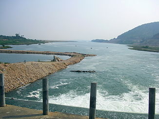
Pennar
|
Pennar Pennaru, Penna, Penner |
||
| Data | ||
| location | Karnataka , Andhra Pradesh ( India ) | |
| River system | Pennar | |
| Headwaters |
Nandi Hills 13 ° 23 ′ 49 ″ N , 77 ° 34 ′ 58 ″ E |
|
| Source height | approx. 900 m | |
| muzzle |
Gulf of Bengal Coordinates: 14 ° 35 ′ 18 " N , 80 ° 11 ′ 39" E 14 ° 35 ′ 18 " N , 80 ° 11 ′ 39" E |
|
| Mouth height | 0 m | |
| Height difference | approx. 900 m | |
| Bottom slope | approx. 1.5 ‰ | |
| length | 597 km | |
| Catchment area | 55,213 km² | |
| Left tributaries | Jayamangali , Kunderu , Sagileru , Maldevi | |
| Right tributaries | Chitravati , Papagni , Cheyyeru | |
| Reservoirs flowed through | Somasila dam | |
| Big cities | Hindupu , Proddatur , Nellore | |
| Medium-sized cities | Gauribidanur , Tadipatri , Jammalamadugu | |
| Small towns | Pamidi | |
The Pennar (also Pennaru , Penna or Penner ) is a river in southern India .
It rises in the Nandi Hills in the state of Karnataka - 50 km north of Bangalore . From there it initially flows north, but then turns east. It is dammed several times. The river breaks through the Eastern Ghats , where it is dammed by the Somasila Dam . The town of Nellore lies on the lower reaches . Finally, 15 km further east at Utukuru it flows into the Bay of Bengal .
The Pennar has a length of 597 km. It drains an area of 55,213 km², of which 87% (48,276 km²) are in Andhra Pradesh and 13% (6,937 km²) in Karnataka. The main tributaries are Jayamangali , Kunderu , Sagileru from the left and Chitravati , Papagni and Cheyyeru from the right. Cities on the Pennar next to Nellore are: Hindupu , Proddatur , Gauribidanur , Tadipatri and Jammalamadugu .
Web links
Individual evidence
- ↑ a b c N. Harish et al: Remote sensing and GIS in the morphometric analysis of macro-watersheds for hydrological Scenario assessment and characterization - A study on Penna river sub-basin, SPSR Nellore district, India. . International Research Journal of Engineering and Technology.
