Petersdorfer See (Bad Saarow)
| Petersdorfer See | ||
|---|---|---|

|
||
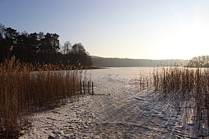
| The Petersdorfer See in winter | ||
| GKZ | DE: 5828411 | |
| Geographical location | Oder-Spree district , Brandenburg, Germany | |
| Tributaries | Petersdorfer Seegraben | |
| Places on the shore | Petersdorf | |
| Data | ||
| Coordinates | 52 ° 18 '55 " N , 14 ° 4' 24" E | |
|
|
||
| Altitude above sea level | 42 m above sea level NHN | |
| surface | 22.97 ha | |
| length | 1.1 km | |
| width | 300 m | |
| volume | 530,000 m³ | |
| Maximum depth | 4.0 m | |
| Middle deep | 2.3 m | |
|
particularities |
||

|
||
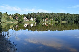
| View over the lake to Petersdorf | ||
The Petersdorfer See is an elongated flat lake in the Scharmützelsee area .
The lake is located in the municipality of Bad Saarow in the Oder-Spree district in Brandenburg about 2.5 kilometers northeast of the Scharmützelsee. It is 23 hectares in size and an average of 2.3 meters deep. Its catchment area has a size of 3.5 km². The only above-ground tributary is the Petersdorfer Seegraben. The lake is about 1100 meters long and a maximum of 300 meters wide from southwest to northeast. Its north-western bank is characterized by the village of Petersdorf and the state road L 35, which runs parallel to the bank, and during the construction of which part of the lake was filled in. Forest dominates in the southeast .
The Petersdorfer See is eutrophic . The average phosphate content in 2003 was 49.6 µg / l. The depth of view was 70 cm. Eels , perch , bream , carp , roach , rudd , tench and pikeperch are found in the lake (as of 2008).
In 1931 a Berlin merchant bought the lake and created a bathing area at the north end. To enable access, he had a dam built that cut off the northern tip of the lake and used it for carp farming . The water is still called the carp pond today . The historic buildings of the seaside resort were demolished in 2014. After being temporarily closed, the lawn has been open again since 2017.
The Petersdorfer See is privately owned. The owner operates the “Wakepark Petersdorf” water ski facility.
Web links
Individual evidence
- ↑ lakes directory seen25 (version 4.1, July 16, 2015) at the Ministry of Rural Development, Environment and Agriculture of the State of Brandenburg, accessed on August 10, 2018th
- ↑ a b c d e Jacqueline Rücker: 10 years of water research in the Scharmützelsee area - trophic and phytoplankton development 1994 to 2003 (PDF; 7.88 MB). In: Jacqueline Rücker, Brigitte Nixdorf (Hrsg.): Gewässerreport Nr. 8 , BTUC-AR 3/2004, ISSN 1434-6834, pp. 7-24.
- ↑ Rainer Deneke, Jacqueline Rücker, Brigitte Nixdorf: Trophy development of deep and shallow lakes in the Scharmützelsee area (Brandenburg) - a summary after 7 years of research (1994-2000) and evaluation according to the LAWA guideline (1999) (PDF; 1.45 MB) . In: Hartwig Krumbeck, Ute Mischke (Hrsg.): Gewässerreport (No. 6): Developments of the waters in the Scharmützelsee area and applied problems of water protection , BTUC-AR 6/2001, ISSN 1434-6834, pp. 5-18.
- ↑ a b Information & history about Bad Saarow , accessed on August 12, 2018.
- ↑ Profile on anglermap.de, accessed on August 10, 2018.
- ↑ Manja Wilde: Petersdorf seaside resort demolished . In: Märkische Oderzeitung , May 10, 2014, accessed on August 11, 2018.
- ↑ Anke Beißer, Bernhard Schwie: Sunbathing lawn at Petersdorfer See open again . In: Märkische Oderzeitung , August 8, 2017, accessed on August 11, 2018.
- ↑ Wakepark Petersdorf , accessed on August 10, 2018.
