Piz da Peres
| Piz da Peres | ||
|---|---|---|
|
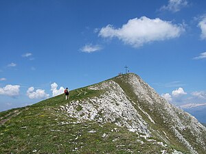
Summit of Piz da Peres from the east |
||
| height | 2507 m slm | |
| location | East of St. Vigil , south of Plan de Corones | |
| Mountains | Braies Dolomites | |
| Dominance | 4 km → Maurerkopf | |
| Notch height | 304 m ↓ Lapaduresjoch | |
| Coordinates | 46 ° 42 '43 " N , 11 ° 58' 47" E | |
|
|
||
| Normal way | From the Furkelsattel over the Dreifingerscharte and Ostrücken | |
The Piz da Peres ( 2507 m slm ) is a frequently visited panoramic mountain in the Braies Dolomites . It is located in the Fanes-Sennes-Braies nature park, southeast of Plan de Corones and east of St. Vigil , from where it is one of the dominating mountains. It forms the western end point of a mountain range extending about seven kilometers in an easterly direction, which shows its rugged and rugged side to the north, especially from the Olang Basin. This is why this chain is also called the Olang Dolomites . To the south, on the other hand, these mountains show mainly moderately steep grass slopes. The Piz da Peres is the most famous mountain in this chain and is often visited as it can be reached from the Furkelsattel ( 1758 m ) on a marked climbing system .
In 2007 Michael Wachtler discovered a rich site of footprints of primitive dinosaurs on Piz da Peres and carried out research together with Marco Avanzini and Rossana Todesco from the Museo Tridentino di Scienze Naturali.
Climbs
The shortest and easiest ascent leads from the Furkelsattel initially in a south-easterly direction with an alternating gradient through the forest. Later the path leads south and finally quite steeply through a scree cirque to the Dreifingerscharte ( 2330 m ), which separates the Piz da Peres from the neighboring Dreifingerpitze to the east . The last part of the ascent leads over the grassy eastern ridge. Approximately 2 hours should be estimated for this increase.
An alternative ascent or descent leads over the west ridge. This route is a little more difficult and insured at some points. This route can be reached either from the Furkelsattel or from St. Vigil.
There are further possibilities from the Pragser Wildsee through the Grünwaldtal to the Dreifingerscharte and from there to the summit or from St. Vigil over the Grünwaldjoch, the Kreuzjoch and the Dreifingerscharte.
Literature and maps
- Hanspaul Menara : South Tyrolean summit hikes. Athesia, Bozen 2001, ISBN 88-8266-013-3
- Franz Hauleitner: Dolomites 3. Val Badia - From Bruneck to Corvara. 4th edition, Munich 2010, ISBN 978-3-7633-4060-6
- Topographic hiking map, Dolomiti di Braies / Pragser Dolomiten - Marebbe / Enneberg , sheet 031, 1: 25,000, Casa Editrice Tabacco, ISBN 88-8315-031-7

