Praunheimer Landstrasse
| Praunheimer Landstrasse | |
|---|---|
| Street in Frankfurt am Main | |
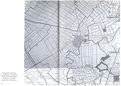
| the location of the street around 1904 | |
| Basic data | |
| place | Frankfurt am Main |
| District | Praunheim and Hausen |
| Created | laid out as a solid path in 1827. |
| Newly designed | around 1986 |
| Connecting roads | north: Praunheimer Brücke or Alt-Praunheim south: Am Hohen Weg or Alt-Hausen |
| Buildings | at the northern end of the entrance to the Buga |
| use | |
| User groups | Pedestrians, cyclists, motorists |
| Technical specifications | |
| Street length | 1.5 km |
Praunheimer Landstrasse is the name of a connecting road in the Frankfurt districts of Praunheim and Hausen . The official street name is K814.
course
The Praunheimer Landstrasse begins in Hausen below the A66 and ends on the Nidda River at the Praunheimer Bridge . As an extension of the Praunheimer Landstrasse, this leads through the center of Praunheim.
History of the road
The future Praunheimer Landstrasse of the future municipality of Praunheim was probably laid out in the Middle Ages, as the Lords of Praunheim were Reichschultheiße of the imperial city of Frankfurt am Main. It is documented that in 1827 the street was expanded as a highway . Until the road was rebuilt for the Federal Garden Show in 1989 , the flood protection wall, which was still visible up to that point, was removed. The street was also straightened and the tram line was dismantled to Hausen and the bus line was extended for this purpose. As part of this, a divided footpath with a bike path was laid out from the outside to the inside. Then comes a strip of green with a parking book and finally the road.
Speed and crossings
The entire length of the street is 50 km / h, the crossings are all equipped with traffic lights .
Local public transport
Former local transport
The Praunheimer Landstrasse has always been an important traffic route. Line 18 of the Frankfurt am Main tram has been running since 1913 (as the successor to the privately operated horse-drawn omnibus that had already been in operation before 1872 ) coming from Schönhof to Praunheimer Brücke . In 1928 the bridge became the end point of the new bus connection through the Römerstadt , which connected Praunheim with the stop of the Frankfurter Lokalbahn (later the lines U1, U2 and U3 of the Frankfurt underground ) in neighboring Heddernheim . Until 1986, the Praunheimer Brücke (on the Hausen side) was the final stop of various tram lines (most recently line 18 again). At the same time, the end point of line 67 was relocated to Hausen or the Industriehof .
After the establishment of the underground line U7 , the partially single-track tram line was discontinued and dismantled between the current terminus at Hausen and the Praunheimer Brücke.
Current local transport
There are several stops in Praunheimer Landstraße, the Hausen stop of the U-Bahn being the most important, as it serves as a transfer stop . Bus lines 72 and 73 run in both directions, as well as night bus N2 in the direction of Konstablerwache on the street side with odd house numbers. Lines 72, 73 and N2 stop there .
House numbers and side streets
The house numbers start in Hausen on the left with the odd house numbers.
building
Except for the initial area, there are single-family houses on the street. A small industry has also accumulated in this area. There are also 3 spiritual institutions on this street ( New Apostolic Church Hesse , Islamic Community Frankfurt eV . And Protestant Church in Hesse and Nassau )
literature
- Helmut Ritzel, Jean H. Rothammel: Pictures to the Praunheimer story. 3. Edition. Frankfurter Sparkasse, Frankfurt am Main 1988.
- Alfred Hansmann: 1200 years of Praunheim. A journey into Praunheim's past. Vereinsring Praunheim, Frankfurt-Praunheim 2004, ISBN 3-00-013189-2 .
Web links
- City of Frankfurt am Main, website. Chronicle of Praunheim .
Individual evidence
- ^ A b Johann Heinrich Bender (ed.): The negotiations of the legislative assembly of the free city of Frankfurt in the years 1816 to 1831 , Verlag GF Krug, 1834, p. 246
- ↑ Stadtvermessungsamt Frankfurt am Main (ed.): Portal GeoInfo Frankfurt , city map
- ↑ RMV
Coordinates: 50 ° 8 ′ 26.8 ″ N , 8 ° 37 ′ 28 ″ E


