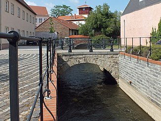
Profener Elstermühlgraben
| Profener Elstermühlgraben | ||
|
The Profener Elstermühlgraben in Pegau |
||
| Data | ||
| location | Saxony-Anhalt , Saxony , Germany | |
| River system | Elbe | |
| Drain over | White Elster → Saale → Elbe → North Sea | |
| source | as a tributary of the White Elster at Profen 51 ° 7 '28 " N , 12 ° 13' 50" E |
|
| muzzle | near Kleindalzig in the White Elster Coordinates: 51 ° 12 ′ 37 " N , 12 ° 17 ′ 34" E 51 ° 12 ′ 37 " N , 12 ° 17 ′ 34" E
|
|
| length | 18.2 km | |
| Big cities | Leipzig | |
| Small towns | Groitzsch , Pegau , Zwenkau | |
| Communities | Profen , Pegau , Kleindalzig | |
The Profener Elstermühlgraben is an artificial branch of the White Elster and has a length of 18.2 kilometers. It is the upper section of a former mill ditch about 29 kilometers long, which was interrupted by the Zwenkau opencast mine . The lower section is the Knauthainer Elstermühlgraben . In terms of water law, the Profener Elstermühlgraben is a first order body of water .
course
The Profener Elstermühlgraben branches off in Saxony-Anhalt between Profen and Löbnitz-Bennewitz, a district of Groitzsch , as Mühlgraben Profen on the left side of the White Elster. It flows very sinuously and mostly accompanied by trees in a northerly direction through the Elsteraue. First it passes Lützkewitz and Beersdorf, two districts of Profen, and then reaches Saxony with a name change to Profener Mühlgraben. A weir was built here east of Bundesstraße 2 in 2015, which serves to protect the settlement areas west of the Bundesstraße from flooding.
These are especially the districts of Elstertrebnitz . In the first, Oderwitz, it passes the first of the eight mills that are marked on the topographical map of Saxony from 1880 on its historical course. This first is the iron mill , in which iron powder was produced from 1915 to 1993 after conventional use and which is still operated as a museum today.
In Pegau , which once had two mills, the mill ditch is enclosed in walls. The Schnellgraben runs past the city to the east. To the north of Profen, the Kleine Floßgraben connects the Elsterfloßgraben with the Profener Elstermühlgraben. After passing Großstorkwitz and Tellschütz, where the Werben trap flows out, the Profener Elstermühlgraben near Kleindalzig flows into the White Elster.
Before its interruption, the original Mühlgraben continued to flow through the now excavated towns of Eythra and Bösdorf , before finally flowing into the White Elster in Leipzig- Großzschocher . Today, in front of the Hartmannsdorf slope, water is branched off from the White Elster, which then flows as Knauthainer Elstermühlgraben in the old bed.
history
The historic Mühlgraben was created in the 12th century by the monks of the Pegau Monastery and at the instigation of Wiprecht von Groitzsch . Its main purpose was the operation of the mills from Elstertrebnitz to Großzschocher, some of which were used until the 20th century.
In the course of the lignite mining, the White Elster was relocated to its current concrete bed between Zwenkau and Leipzig between 1972 and 1977 and the Mühlgraben near Kleindalzig was integrated into it or branched off again at Hartmannsdorf. Its dry-fallen bed lying in between, about five kilometers long, was devastated by the overburden excavators from 1984 onwards . To the south of the former Eythra, the Mühlgraben between Betonelster and Zwenkauer See is still preserved, but it no longer has any water because of the lowered groundwater level.
Web links
Individual evidence
- ↑ a b Water quality mapping in the river network southern Leipzig ( Memento from January 4, 2014 in the Internet Archive ) Klemm & Hensen, Leipzig, 2001-2003, on: klemm-hensen.de (PDF; German; 1.5 MB)
- ↑ Leipziger and Schkeuditz Waters brochure of the Naturschutzbund Deutschland (NABU) Landesverband Sachsen e. V .; On: sachsen.nabu.de (PDF; German; 7.64 MB)
- ↑ Administrative community Pegau - Elstertrebnitz - environmental report , p. 20
- ↑ according to Google Maps
- ↑ Julia Tonne: Weir in Elstertrebnitz is ready. In: LVZ from December 18, 2015. Retrieved July 14, 2019 .
- ↑ Topographic maps, sheets Pegau and Zwenkau 1880
- ↑ The iron mill museum. Retrieved July 14, 2019 .


