
Pyramid Lake (Nevada)
| Pyramid Lake | ||
|---|---|---|

|
||
| Satellite map | ||
| Geographical location | Large pool | |
| Tributaries | Truckee River | |
| Drain | drainless (evaporation) | |
| Islands | Anaho Island, The Pyramid | |
| Places on the shore | Sutcliffe | |
| Location close to the shore | Reno | |
| Data | ||
| Coordinates | 40 ° 2 ′ N , 119 ° 34 ′ W | |
|
||
| Altitude above sea level | 1155 m | |
| surface | 487 km² | |
| length | 48 km | |
| width | 14 km | |
| volume | 29.18 km³ | |
| scope | 160.1 km | |
| Maximum depth | 109 m | |
| Middle deep | 59.9 m | |
| Catchment area | 4730 km² | |

|
||
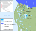
| Environment map | ||

The Pyramid Lake [ ˈpɪrəmɪd ˌleɪk ] (literally " Pyramid Lake ") is a drainless lake in the US state of Nevada . It has an area of 487 km² and is located about 60 km northeast of Reno in the Great Basin . The lake is around 40 km long and 20 km wide and is fed by Lake Tahoe via the Truckee River .
The lake is surrounded by steppe - like, desert-like landscapes. It's a holdover from Lake Lahontan , a post-glacial lake; a reservoir not far away still bears this name ( Lahontan Reservoir ). Despite the abundant supply of water that it receives from the Truckee River , its water content is steadily decreasing, since in the hot and dry desert climate, evaporation is greater than the amount of inflowing water. The salinity is about 1/6 that of sea water.
In the south of the lake is the 2.567 km² Anaho Island , which is known for its tuff formations. It is home to a large colony of the rhinoceros pelican . Two kilometers northeast of Anaho Island and 175 meters from the eastern shore of the lake is the eponymous island, The Pyramid . It has a floor plan of 208 by 143 meters, an area of around two hectares, and a height of 105 meters above lake level.
In the area around the lake, in the now dry Winnemucca Lake on the other side of the Lake Range , large-scale petroglyphs were found, which can be dated to an age between 14,800 and 10,300 years through the layers of tuff above the incisions. They are the oldest known petroglyphs in North America and a symbol of early cultural or artistic activities.

Name-giving rock island The pyramid

Aerial view

View directly to the shore
Map of the northwestern United States during the Pleistocene era some 17,500 years before our time


Web links

Individual evidence
- ^ LV Benson, EM Hattori, et al .: Dating North America's oldest petroglyphs, Winnemucca Lake subbasin, Nevada . In: Journal of Archaeological Science , Volume 40 (2013) pages 4466-4476, doi: 10.1016 / j.jas.2013.06.022