Quiriquina
| Quiriquina | ||
|---|---|---|
| Waters | Bahía de Concepción , Pacific Ocean | |
| Archipelago | Región del Bío-Bío | |
| Geographical location | 36 ° 37 '33 " S , 73 ° 3' 39" W | |
|
|
||
| length | 5.3 km | |
| width | 1.6 km | |
| surface | 4.86 km² | |
| Highest elevation | 120 m | |
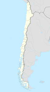
| Location of the island | ||
Quiriquina is a Chilean island. It is located at the entrance of the Bay of Concepción , eleven kilometers north of the city center of Talcahuano and belonging to the urban area. The name of the island comes from the Mapuche language and means "many true thrushes". The island is known for its fossil finds .
geography
The island is 5.3 km long from northeast to southwest, maximum 1.6 km wide, and has an area of 4.86 km².
history

In April 1557, Don Garcia de Mendoza , Spanish governor of Chile , reached Concepción with a large army and settled on the island. Quiriquina became a military base for the fight against the Mapuche in the Arauco War .
On his trip around the world with the HMS Beagle , Charles Darwin visited the island shortly after the earthquake in the nearby town of Concepción in 1835. There he investigated the effects of the earthquake and found marine debris that had been raised several feet by the earthquake. He found another confirmation of Charles Lyell's theory about the structure of the earth's crust.
In 1882/83 the German geologist Gustav Steinmann and in 1903 his student Otto Wilckens explored the island.
During the First World War , the crew of the German cruiser SMS Dresden were interned by the Chilean government. Among the prisoners was the future Admiral Wilhelm Canaris , who escaped with two other members of the crew. Canaris was later during the Nazi era from 1935 to 1944 head of the Abwehr , the military secret service of the Wehrmacht .
In 1931, after a mutiny in the Chilean Navy, the Almirante Riveros brought their dead and injured to the island.
After the Chilean coup in 1972, Augusto Pinochet used the island as a concentration camp for political prisoners. The camp existed from September 11, 1973 to April 1975.
Attractions
There is a lighthouse in the northwest of the island . Fort Rondizzoni is in the southeast.
Web links
Individual evidence
- ^ PNAS Islands Database
- ^ Concentration camp website , accessed on August 26, 2015


