Río Abuná
| Río Abuná - Rio Abunã | ||
|
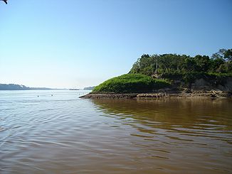
Mouth of the Río Abuná (right) into the Rio Madeira |
||
| Data | ||
| location |
|
|
| River system | Amazon | |
| Drain over | Rio Madeira → Amazon → Atlantic Ocean | |
| Confluence of | Rio Iné and Rio Xipamanú 10 ° 43 ′ 1 ″ S , 68 ° 6 ′ 19 ″ W |
|
| Source height | approx. 170 m | |
| muzzle |
Rio Madeira Coordinates: 9 ° 40 ′ 18 ″ S , 65 ° 26 ′ 47 ″ W 9 ° 40 ′ 18 ″ S , 65 ° 26 ′ 47 ″ W. |
|
| Mouth height | approx. 100 m | |
| Height difference | approx. 70 m | |
| Bottom slope | approx. 0.19 ‰ | |
| length | 375 km | |
| Catchment area | 25,870 km² | |
| Right tributaries | Río Kharamanu, Río Negro | |
| Communities | Abunã | |
| Navigable | 320 km | |
|
River network with the Río Abuná in the Beni lowlands |
||
The Río Abuná ( Brazilian : Rio Abunã ) is a left tributary of the Rio Madeira in the Amazon lowlands in South America .
River course
The upper reaches of the river are formed by various smaller rivers that have their origins in the Cordillera Oriental of the Peruvian Andes . The river has a total length of 375 km, 320 km of which is navigable in the lower reaches, and flows in a northeastern direction. A part of the lower reaches up to the confluence with the Rio Madeira forms the border between the northern Bolivia and the western Brazil .
Both the Bolivian settlement of Manoa and the Brazilian village of Abunã are located at the mouth of the Abuná .

