Río Llushin
| Río Llushin | ||
|
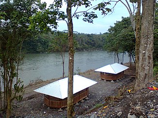
Río Llushin on the lower reaches |
||
| Data | ||
| location |
|
|
| River system | Amazon | |
| Drain over | Río Pastaza → Río Marañón → Amazon → Atlantic Ocean | |
| Headwaters |
Cordillera Real , 7 km northeast of El Altar volcano 1 ° 37 ′ 16 ″ S , 78 ° 21 ′ 37 ″ W |
|
| Source height | approx. 3700 m | |
| muzzle | 7.5 km northwest of Palora Coordinates: 1 ° 40 ′ 7 ″ S , 78 ° 1 ′ 33 ″ W 1 ° 40 ′ 7 ″ S , 78 ° 1 ′ 33 ″ W |
|
| Mouth height | approx. 860 m | |
| Height difference | approx. 2840 m | |
| Bottom slope | approx. 36 ‰ | |
| length | 78 km | |
| Catchment area | 925 km² | |
| Left tributaries | Río Cuyuimi | |
| Right tributaries | Río Verde, Río Chuya Llushin, Río Amundal | |
The Río Llushin is a 78 km long right tributary of the Río Pastaza in the far north of the Morona Santiago province in Ecuador .
River course
The headwaters of the Río Llushin are located in the Cordillera Real 7 km northeast of the El Altar volcano at an altitude of about 3700 m . The Río Llushin initially flows 5 km to the east and turns to the north for the next 8 km. The Río Llushin flows east up to river kilometer 52 and then turns sharply south. The rest of the route of the Río Llushin flows mainly in a south-easterly direction from the mountains. At river kilometers 6 and 1, at the foot of the Andes , the rivers Río Chuya Llushin and Río Amundal meet the Río Llushin from the south. This finally flows into the Río Pastaza 7.5 km northwest of Palora .
Catchment area
The catchment area of the Río Llushin extends over the eastern slope of the Cordillera Real. It covers an area of 925 km². In the west it borders on that of the Río Puela , in the south on that of the Río Palora . The Río Pastaza runs north and east of the catchment area. The catchment area above river kilometer 6.5 is located within the Sangay National Park .
