|
Río San José
|
|
Course of the Río San José in the department of San José
|
| Data
|
| location
|
South America , Uruguay
|
|
River system
|
Río de la Plata
|
| Drain over
|
Río Santa Lucía → La Plata → Atlantic
|
|
source
|
in the Cuchilla Grande Inferior between La Casilla and Cerro Colorado
|
|
muzzle
|
northeast of the city of Libertad in the Río Santa Lucía Coordinates: 34 ° 35 ′ 27 ″ S , 56 ° 29 ′ 59 ″ W 34 ° 35 ′ 27 ″ S , 56 ° 29 ′ 59 ″ W-34.590833333333 -56.499722222222
-34.590833333333 -56.499722222222
|
|
Catchment area
|
3543 km²
|
|
Left tributaries
|
Arroyo Corral de Piedra , del Juncal, de la Quinta, Arroyo de Pintos , Arroyo San Gregorio , Arroyo Juan Esteban , Arroyo Juan Isidro , Arroyo Pantanoso , Sauce, Arroyo Guayabos , Miranda, Piedras de Afilar, Arroyo Chamizo , Arroyo Carreta Quemada , Arroyo del Raigon , NN (Arroyo Sauce Chico or Arroyo Sauce Grande), NN, Arroyo Cagancha , NN, Arroyo Sarandí Grande , de los Burros
|
|
Right tributaries
|
Arroyo Sarandí Grande , Arroyo Bolas Grande , Arroyo del Sauce , Arroyo Hernández , Arroyo Guaycuru , Arroyo Mahoma , del Sauce, del Pajonal, del Puerto, Tala, Arroyo Coronilla , Arroyo del Sauce , Patricios, Arroyo Fajina , Arroyo Jesús María , NN ( Arroyo A Pachina or Arroyo Sauce ), Zanja Honda, NN (Arroyo Larriera or Arroyo Rocho or Arroyo Mallada), Arroyo del Tala , La Lista (possibly only side arm), Zárate, del Lloron, Arroyo Castellano , Arroyo Gregorio , Arroyo Sauce , de la Arena, Arroyo Valdéz , del Horno, Arroyo Albornoz , de la Chancha Mora, Arroyo Flores
|
|
Medium-sized cities
|
San Jose de Mayo
|
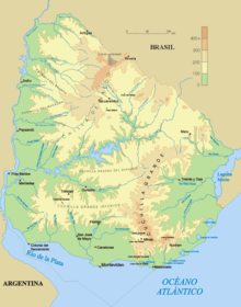
The Río San José is a river mainly located in the area of the Department of San José in southern Uruguay .
The tributary of the Río Santa Lucía has its source in the Cuchilla Grande Inferior in the Flores department between La Casilla in the west and Cerro Colorado in the east. It then flows through San José in a north-west-south-east direction, touches the city of San José de Mayo and is fed on its way by the Arroyo San Gregorio , Arroyo Chamizo , Arroyo Carreta Quemada and Arroyo Cagancha . It flows into the Río Santa Lucía a few kilometers northeast of the city of Libertad . Its catchment area covers 3543 km².
Map showing the entire course of the river
Individual evidence
-
^ Enciclopedia Geografica del Uruguay
-
^ Enciclopedia Geografica del Uruguay


