Río Tuichi
| Río Tuichi | ||
|
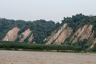
Steep slope on the Tuichi River in the Madidi National Park |
||
| Data | ||
| location |
|
|
| River system | Amazon | |
| Drain over | Río Beni → Rio Madeira → Amazon → Atlantic | |
| Confluence of | Río Pelechuco and Río Sunchuli 14 ° 42 ′ 5 ″ S , 68 ° 45 ′ 25 ″ W |
|
| Source height | approx. 1050 m | |
| muzzle |
Río Beni Coordinates: 14 ° 35 ′ 36 ″ S , 67 ° 32 ′ 26 ″ W 14 ° 35 ′ 36 ″ S , 67 ° 32 ′ 26 ″ W. |
|
| Mouth height | 220 m | |
| Height difference | approx. 830 m | |
| Bottom slope | approx. 3.1 ‰ | |
| length | 265 km | |
| Left tributaries | Río Queara | |
The Río Tuichi is a left tributary of the Río Beni on the eastern slopes of the Bolivian Andes in South America .
The upper reaches of the river form various smaller rivers, which have their origin in the Cordillera Apolobamba of the Bolivian Eastern Andes . The river and its source rivers flow through the Madidi National Park in the province of Franz Tamayo and have a total length of over 300 km. From its source, the Tuichi flows for 110 km in a northeasterly direction to 14 ° 6 ′ S , 68 ° 19 ′ W , then turns for a further 155 km in a south-easterly direction and here forms the border river between the province of Franz Tamayo and the province of Abel Iturralde .
After a total length of 265 km, the Río Tuichi flows into the Río Beni , 25 km upstream south of the town of Rurrenabaque .
