Cordillera Apolobamba
| Cordillera Apolobamba | ||
|---|---|---|
| Highest peak | Chaupi Orco ( 6044 m ) | |
| location | Border Departamentos Puno , Peru / La Paz , Bolivia | |
| part of | To the | |
|
|
||
| Coordinates | 14 ° 28 ′ S , 69 ° 5 ′ W | |
| surface | 4,837 km² | |
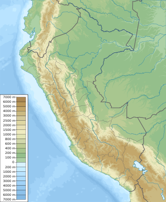
The Cordillera Apolobamba is a mountain range in the eastern border area of Bolivia and Peru . The Cordillera Apolobamba extends over 4837 square kilometers and is located in the departments of Puno (Peru) and La Paz . The higher mountains are partly heavily glaciated and have a strong alpine character. The main places in the Apolobamba area are the eponymous Apolo , Pelechuco , Charazani and, at an altitude of 3,800 m above sea level, Curva , the main town of the Kallawaya people.
mountains
The highest peak of the Cordillera Apolobamba is the 6,044 meter high Chaupi Orco . Other important mountains are the sharply cut Cololo at 5,916 meters, Palomani Grande (5,730 m), Nubi (5,710 m), Canisaya (5,706 m), Montserrat Norte (5,655 m) and the relatively easy-to-climb Cuchillo at 5,655 m.
climate
The climate in the Apolobamba area is characterized by the high altitude and is rather cool. In the winter dry season it is almost continuously sunny during the day. The solar radiation is very strong and heats the air up to 20 degrees. Due to the lack of cloud cover and the high altitude, the nights are very cold with often double-digit minus degrees. In the rainy season, the nights are less cold and the days are less warm due to the afternoon clouds. The annual average temperature in the highlands is 4.5 degrees Celsius. The annual rainfall is between 300 and 1900 mm, depending on the altitude, sun exposure and the location to neighboring mountain ranges.
flora
In the entire area of the Cordillera Apolobamba 807 different plant species are registered, estimates are about 1500 species. The high Andean vegetation consists mainly of hard mosses, the Bofedales and the hard and stinging Ichu grass ( Jarava ichu ). The Queñua tree, which has become very rare in the Andes , can grow up to a height of almost 5000 meters . In the cloud forest and the transition areas to the tropical rain forest , almost all imaginable plant forms are represented.
fauna
The Cordillera Apolobamba is home to the highest condor density in Bolivia , but the large scavengers are seldom seen. Even the puma can still be found in the Puna regions, but is also rarely found because of its shyness. The Andean fox can be seen much more often, and the rabbit- like Viscachas , which mostly hide between stones , are even more common . The domesticated llamas and alpacas can be found on almost any suitable plateau. You can also see lizards very often, as well as smaller bird of prey species such as the hawk.
history
During the Inca rule in the 13th century, Yáhuar Huácac crossed the Cordillera with 15,000 men and conquered the region on the Amaru Mayu , today's Río Madre de Dios . A century later, the Inca Túpac Yupanqui and 10,000 men followed in the footsteps of his great-grandfather down to the Beni region in the Amazon lowlands. Later, Yupanqui's son, Huayna Cápac , sent his general Hurcu Huaranca to the region with another 10,000 men.
After the Spanish conquests in search of the famous Patití or El Dorado , the governor of the Arexaca Province (today: Larecaja Province ), Juan Álvarez de Maldonado , founded the city of Apolo in 1573 and was the first Spaniard to research the region.
hike
There is a common 5-day crossing of the area from Pelechuco to Curva. Several passes have to be overcome by 5000 meters. In the absence of accommodation, the tour can only be accomplished with tents and pack animals. Parts of the path are only suitable for sure-footed hikers, but mostly roadways are used that open up the few remaining gold mines.
Individual evidence
- ↑ César AM Gomez : History of Apolo and the Province of Franz Tamayo (1990)
- ↑ Ecoturismo Comunitario del Camino Kallawaya UNDP
Web links
- The Apolobamba ( English )
- Apolobamba from Mesili
- Trek Apolobamba ( English )
- Integrated Management Natural Area ( English )
