Río Beni
| Río Beni | ||
|
Confluence of the Río Mamoré (front left) and Río Beni (back left) to the Rio Madeira (to the right) |
||
| Data | ||
| location |
|
|
| River system | Amazon | |
| Drain over | Rio Madeira → Amazon → Atlantic | |
| Confluence of |
Río Kaka and Río Alto Beni 15 ° 6 ′ 57 ″ S , 67 ° 40 ′ 23 ″ W |
|
| Source height | 286 m | |
| Union | east of Nova Mamoré with the Río Mamoré to Rio Madeira Coordinates: 10 ° 22 ′ 56 ″ S , 65 ° 23 ′ 25 ″ W 10 ° 22 ′ 56 ″ S , 65 ° 23 ′ 25 ″ W |
|
| Mouth height | approx. 107 m | |
| Height difference | approx. 179 m | |
| Bottom slope | approx. 0.15 ‰ | |
| length | approx. 1180 km (including source rivers: 1600 km) | |
| Catchment area | approx. 280,000 km² | |
| Outflow location: 30 km above the mouth |
MQ |
8900 m³ / s |
| Left tributaries | Río Coroico , Río Tuichi , Río Emero, Río Madidi , Río Madre de Dios , Río Orthon | |
| Right tributaries | Arroyo Verde, Río Ivon, Río Geneshuaya | |
|
Amazon basin, Beni river highlighted |
||
|
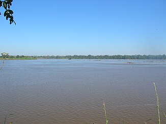
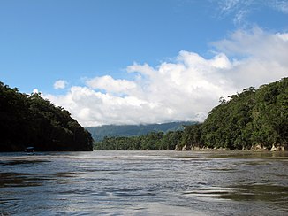
The Río Beni reaches the Amazon lowlands |
||
|
The Río Beni in northern Bolivia just before Riberalta |
||
The Río Beni (formerly: Uchapara ) is the left, slightly larger headwaters of the Rio Madeira , one of the right-hand tributaries of the Amazon River .
River course
The Río Beni rises on the eastern slope of the Bolivian Cordillera Real ("Königskordillere"). Its catchment area covers 280,000 km². The upper reaches of the Beni River, the Cotacajes River , unites near San Miguel de Huachi with the Río Boopi to Rio Alto Beni and flows from there to the north. At the twin cities of Rurrenabaque and San Buenaventura , 1000 km above its mouth, the river breaks through the last mountain bar of the eastern Voranden on its way into the Amazon lowlands.
Over millions of years, the sediments washed out of the Andes massif have created an extensive alluvial plateau between the Río Beni and the Río Mamoré further to the east .
160 km above its mouth, the Río Beni near the city of Riberalta takes on the significantly larger Río Madre de Dios . In some maps this last part of the river is called "Madre de Dios", but official Bolivian maps show it as "Río Beni". This last section of the river widens to up to two kilometers, even with medium water flow (8,900 m³ / s). After a total length of about 1,600 km, the Río Beni joins the Río Mamoré (mean water flow: 8,200 m³ / s) to the Rio Madeira , the most powerful tributary of the Amazon.
use
The navigability of the Río Beni is limited because 30 km above its mouth near the town of Cachuela Esperanza, huge rapids interrupt shipping. In the dry season, tidal waves can reach heights of up to 8 meters here. The Bolivian government has plans to tame the river by building a hydroelectric power station at this point and generating electricity for export to Brazil .
The Beni River is known for its high gold content, which in the form of gold - soaps , especially from the tributaries of the upper reaches at Teoponte and Tipuani comes.
The largest tributaries
Of the tributaries listed below , the Río Madre de Dios is by far the most water-rich.
- Río Coroico (left)
- Río Tuichi (left)
- Río Emero (left)
- Río Madidi (left) (see Madidi National Park )
- Arroyo Verde (right)
- Río Ivon (right)
- Río Geneshuaya (right)
- Río Madre de Dios (left)
- Río Orthon (left)
See also
Web links
Individual evidence
- ↑ The total length Beni - Alto Beni - Cotacajes - Sacambaya - Ayopaya - Leque - Tallija is given as around 1,620 kilometers. The section of the river called Beni is almost 1,180 kilometers long.
- ↑ At Cachuela Esperanza , source: Info on the local power plant project ( memento of the original from June 24, 2010 in the Internet Archive ) Info: The archive link has been inserted automatically and has not yet been checked. Please check the original and archive link according to the instructions and then remove this notice.
- ^ Kümmerly + Frey Rand McNally : International Atlas . Published by Georg Westermann Verlag ISBN 3-07-508962-1


