Raba (Vistula)
| Raba | ||
|
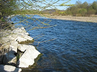
The Raba at the confluence of the Krzyworzeka |
||
| Data | ||
| location | Lesser Poland Voivodeship , Poland | |
| River system | Vistula | |
| Drain over | Vistula → Baltic Sea | |
| source | at the pass of the Przełęcz Sieniawska 49 ° 31 ′ 20 ″ N , 19 ° 57 ′ 34 ″ E |
|
| Source height | 750 m npm | |
| muzzle | below Uście Solne in the Vistula Coordinates: 50 ° 8 ′ 15 " N , 20 ° 30 ′ 33" E 50 ° 8 ′ 15 " N , 20 ° 30 ′ 33" E
|
|
| length | 131.9 km | |
| Catchment area | 1,537.1 km² | |
| Left tributaries | Mszanka , Stradomka (Raba) | |
| Reservoirs flowed through | Jezioro Dobczyckie | |
| Medium-sized cities | Bochnia | |
| Small towns | Rabka-Zdrój , Mszana Dolna , Myślenice , Dobczyce | |
The Raba is a right tributary of the Vistula in Poland . It rises at the Przełęcz Sieniawska pass in the Beskids and runs in a north-easterly direction via Rabka-Zdrój , Mszana Dolna , from there to the north-north-west to Myślenice and from there to the north-east via Dobczyce and Bochnia to the confluence with the Vistula near Uście Solne . The length of the run is 131.9 km. Its catchment area is given as 1537.1 km².
The Raba flows through the 10.7 km² reservoir Jezioro Dobczyckie above Dobczyce .
Commons : Raba - collection of images, videos and audio files


