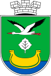
Darnytsia district
| Darnytsia district | ||
| (Дарницький район / Darnyzkyj raion) | ||

|

|
|
| location | ||
|---|---|---|
| Oblast : | - | |
| City : | Kiev | |
| Basic data | ||
| Height : | Information is missing | |
| Geographic location : | 50 ° 24 ' N , 30 ° 39' E | |
| Area : | 133.63 km² | |
| Residents : | 347,427 (2020) | |
| Population density : | 2,599.92 inhabitants per km² | |
| Postcodes : | 02xxx | |
| Area code : | +380 44 | |
| KOATUU : | 8036300000 | |
| District administration | ||
| Address : | вул. Олександра Кошиця 11, 02068 м. Київ ( German 11, Alexander Kosice Street, Kiev ) |
|
| Head: | Information is missing | |
| Website : | http://darn.kievcity.gov.ua/ | |
| Overview map | ||
|
|
||
| Statistical information | ||
The darnytsia ( Ukrainian Дарницький район
Darnyzkyj raion ; Russian Дарницкий район Darnizkij rayon ) is one of ten counties ( Rajone ) the city of Kiev , capital of Ukraine .
Darnytsia Raion is located in the southeast of the city on the left bank of the Dnieper and was founded in 1935. The Rajon has 347,427 inhabitants (2020) and an area of about 134 km². The population density in the Rajon is 2486 inhabitants per km². In the north of the Rajon lies the Darnytsia railway station .
Population development
| 1959 | 1970 | 1979 | 1989 | 2001 | 2008 | 2016 | 2020 |
|---|---|---|---|---|---|---|---|
| 94.111 | 177,403 | 248,883 | 153,761 | 282,359 | 302,560 | 332.265 | 347,427 |
Sources: 1959–2008: 2016: 2020
Web links
Commons : Left bank districts of Kiev - Collection of images
- official website of the city of Kiev (Ukrainian)
- History of Darnytsia Raion (Ukrainian)
Individual evidence
- ↑ Головне управління статистики м.Києва - Чисельність населення (щомісячна інформація). Retrieved May 15, 2020 .
- ↑ City districts in Ukraine on pop-stat.mashke.org
- ↑ Darnyzja district on citypopulation.de, last accessed on March 5, 2017
- ↑ Головне управління статистики м.Києва - Чисельність населення (щомісячна інформація). Retrieved May 15, 2020 .
