Rama (river)
| Rama | ||
|
The Ramsko jezero reservoir covers the upper reaches of the river |
||
| Data | ||
| location | Bosnia and Herzegovina | |
| River system | Neretva | |
| Drain over | Neretva → Mediterranean | |
| source | near Varvara, municipality of Prozor-Rama 43 ° 48 ′ 52 ″ N , 17 ° 29 ′ 31 ″ E |
|
| muzzle |
Jablanica lake at Ustirama coordinates: 43 ° 41 '38 " N , 17 ° 43' 56" O 43 ° 41 '38 " N , 17 ° 43' 56" O
|
|
| length | 34 km | |
| Reservoirs flowed through | Ramsko jezero | |
| Communities | Prozor-Rama | |
The Rama is a river in Bosnia and Herzegovina . It flows through northern Herzegovina and flows into the Neretva .
Run
The Rama rises from the karst springs Buk and Krupić near the village of Varvara, which today are normally located under the water surface of the Ramsko jezero reservoir created in 1968 west of Prozor in the municipality of Prozor-Rama ( canton of Herzegovina-Neretva ), so that the actual course of the river the Rama only begins below the dam. More streams from the Vran and Zahum mountains flow into the lake .
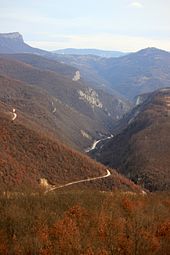
Below the Ramsko jezero at 595 meters, the Rama initially flows a few kilometers through a narrow valley in an easterly direction before turning to the southeast. From here the road between Prozor and Jablanica leads through the Rama Gorge. At Gračac, the Rama flows into the Jablaničko jezero , which floods the last section of the original gorge. Originally, the mouth of the river into the Neretva was a few kilometers southeast of the village of Ustirama ("mouth of the Rama"), which, however, was relocated in the course of the damming of the Jablaničko jezero. The former mouth is not far from the Jablanica dam and is only visible today when the water is extremely low.
The length of the original course of the river was 34 kilometers, nine kilometers of which have been preserved since the two reservoirs mentioned were dammed.
The only notable places directly on the river are the villages Gračanica and Gračac, which belong to the municipality of Prozor-Rama.

