Ramsdorf (Owschlag)
|
Ramsdorf (Owschlag)
municipality Owschlag
Coordinates: 54 ° 24 ′ 3 ″ N , 9 ° 36 ′ 44 ″ E
|
||
|---|---|---|
| Incorporation : | April 1, 1941 | |
|
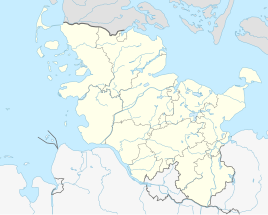
Location of Ramsdorf (Owschlag) in Schleswig-Holstein |
||
Ramsdorf is a small sub-village of Owschlag with 100 inhabitants; it was first mentioned as Ramstorp in 1462 and, as part of the community Owschlag, has belonged to the Hüttener Berge office since January 1, 2008 .
Ramsdorf is on Landesstraße 265. There is a bus connection from Autokraft GmbH between Owschlag and Eckernförde . The route leads from Eckernförde (ZOB / Bahnhof) via Windeby , Kochendorf, Friedland, Osterby , Damendorf , Hütten to Ascheffel . From Ascheffel on via Ahlefeld , Brekendorf , Ramsdorf to Owschlag and back.
The homeless shelter in Ramsdorf is used by the Hüttener Berge office as a refugee home.
Ramsdorf maintains a volunteer fire brigade .
Web links
- Homeless shelter Owschlag district Ramsdorf on amt-huettener-berge.de
- History on amt-huettener-berge.de
Individual evidence
- ↑ The municipalities → Owschlag ( Memento of the original from February 27, 2016 in the Internet Archive ) Info: The archive link was inserted automatically and has not yet been checked. Please check the original and archive link according to the instructions and then remove this notice. at amt-huettener-berge.de
- ↑ Seehotel becomes a refugee home. In: SHZ from September 23, 2015. From the editorial staff of the state newspaper. Retrieved February 27, 2016 .
