Red Hills (Kansas)
| Red Hills | ||
|---|---|---|
| Highest peak | Mount Nebo ( 744 m ) | |
| location |
Kansas , Oklahoma , United States |
|
|
|
||
| Coordinates | 37 ° 21 ′ N , 99 ° 5 ′ W | |
|
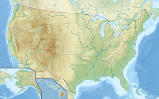
Red Hills in southern Kansas and northern Oklahoma |
||
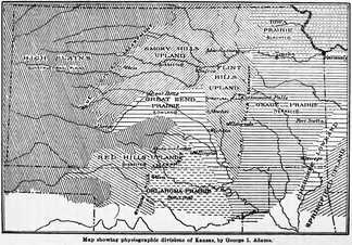
The Red Hills , also known as the Gypsum Hills , are a region primarily in Clark , Comanche, and Barber Counties in central southern Kansas and northern Oklahoma in the United States . The hilly terrain of red sediments contrasts with the surrounding landscape of the Great Plains of Kansas.
Emergence
The red sediments of the Red Hills were deposited about 260 million years ago in a continental, endorheic basin that formed during the Permian within the supercontinent of Pangea . The basin was temporarily flooded by water and formed temporarily flooded sinks with acidic water. The shallow valleys were flooded irregular and dried temporarily out, wherein a mixture of lacustrine sediments and gypsum - evaporite remained. The red color comes from the oxidation of the iron contained in the deposits.
geography
The region is mainly located in southern Kansas, but extends into northern Oklahoma and is also known as the Gypsum Hills because of the large natural gypsum deposits in the area. The dissolution of the plaster beds below has resulted in the formation of sinkholes , which are common in the Red Hills region. Big Basin with a diameter of 1.6 km and a depth between 30 and 45 meters and Little Basin with a diameter of 256 meters and a depth of 10 meters are two well-known sinkholes in western Clark County, which are partly covered by the Big Basin Conservation Area Prairie Preserve to be protected. In contrast to the limestone of the Flint Hills further east, the gypsum is relatively easily soluble in water, so that numerous caves have been created in the Red Hills. Of the 528 cataloged caves in the state of Kansas, 128 are in Comanche County and 117 are in Barber County in the Red Hills region, which are typically between 30 and 90 meters long. There are also smaller natural stone bridges in the region.
An anticline called the Pratt Anticline runs on the western edge of Barber County and is likely to contribute to minor earthquake activity in the area.
The Red Hills have scenic views and some small steep canyons . Due to the low rainfall in the region, there are few trees and it is generally dry, so that the slopes of the hills are reminiscent of the table mountains in Arizona and New Mexico . The highest points include Mount Nebo (744 m), Mount Jesus (710 m) and Mount Lookout (710 m).
economy
The gypsum from the Red Hills was first mined southwest of Medicine Lodge in 1888 and is still mined in an open pit and underground mine north of Sun City for subsequent processing.
Web links
Individual evidence
- ^ A b Kansas Geological Survey staff: Red Hills: Rocks and Minerals . In: In: Geofacts from the Kansas Geological Survey . Kansas Geological Survey. P. 2 pp ..
- ^ A b c d Red Hills , Kansas Geological Survey, The University of Kansas. Accessed April 11, 2020
- ^ JK Warren, 2006. Evaporites: sediments, resources and hydrocarbons . Berlin: Springer-Verlag, p. 1035 ff.)
- ↑ KC Benison, RH Goldstein, 2001. Evaporites and siliciclastics of the Permian Nippewalla Group of Kansas, USA: a case for non-marine deposition in saline lakes and saline pans. Sedimentology 48 (1): 165-188.
- ↑ Big Basin and Little Basin , Kansas Geological Survey, The University of Kansas. Accessed April 11, 2020
- ^ Red Hills , Kansas Historical Society. Accessed April 11, 2020

