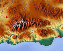
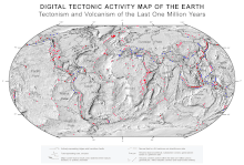
Relief map

A relief map is a topographic map that shows the relief , i.e. the three-dimensional shape of the earth's surface , in a two-dimensional representation. With this type of map design , a vivid appearance should be achieved.
In the history of cartography attempts have been made to solve the problem of elevation display using various methods. In the case of early maps such as the Tabula Peutingeriana , pile-like signatures were used to represent elevations . It was only with the advances in geometry and cartography of the early modern period that the representation of heights also developed further - including with shadow sculpture. The attempt was made to graphically depict the height ratios, which were not yet or only insufficiently measured, by means of approximate shading. In the 19th century, hatching was primarily used to illustrate the terrain more clearly. In the school atlases which was from the late 19th century physical card with regional colors introduced.
In the classic maps of cartography, on the other hand, the terrain is displayed in contour lines , since the beginning of the 20th century mostly supplemented by shading to indicate the relative height differences. Contour lines alone convey little to the untrained observer about the plasticity of the surfaces shown. On the other hand, relief representations on maps can lead to ideas that differ greatly from the object.

The term relief map is used in schools for school maps of various shapes and types relating to the relief :
- General geographic maps and other topographic base maps with accentuated and very three-dimensional relief display (e.g. Haack-Peuckert-Manner, Wenschow-Maps , Swiss Manner ).
- Thematic maps of the relief (e.g. relief type maps, elevation maps, morphographic maps).
- Cartographic reliefs (high relief maps ): In this map-related representation, the height structure of an area is scaled down but implemented three-dimensionally and in most cases exaggerated . Surface colors used can illustrate layers of elevation, vegetation, land use or other aspects. To distinguish it from the two-dimensional representations (1. and 2.), it is sometimes also referred to as a plastic map . Such models of the earth's surface were also referred to as relief maps outside of education until the 20th century.
literature
- Egon Breetz: The relief representation on general geographic and selected thematic maps for geography lessons. Potsdam Research, Series C, Issue 12, PH Potsdam 1973.
- Max Eckert: The map science. Research and fundamentals on cartography as a science. Volume 1, Walter de Gruyter & Co, Berlin / Leipzig 1921, p. 406: The touch and search for a terrain representation in the Middle Ages. P. 490 ff .: The portrait maps. The Swiss relief maps or the maps in Swiss style. ( archive.org ).
- Hans Mirus: Plastic maps for geography lessons. In: Zt. Fd Erdkundeunterr., H. 8/9/1966, pp. 314–323.
Individual evidence
- ↑ About the representation of the vertical floor design on maps and plans. In: Deutsche Bauzeitung. Berlin 1883, No. 1/2, p. 7 - digitized version (PDF 9.6 MB, accessed on January 16, 2013)
- ^ A b Franz Heiderich: Shadow sculpture and color sculpture. In: Communications of the Imperial and Royal Geographic Society. XLII, Vienna 1899, p. 19 f., Review of Karl Peucker's Kartographische Studien I 1898 ( Textarchiv - Internet Archive ).
- ^ Meyer's Large Conversational Lexicon at Zeno.org .
Web links
- Free Relief Layers for Google Maps. Hans Braxmeier, accessed on January 16, 2013 (English, global relief maps).