Rhoon
 flag |
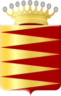
 coat of arms |
| province |
|
| local community |
|
|
Area - land - water |
4.03 km 2 4 km 2 0.03 km 2 |
| Residents | 7,820 (Jan. 1, 2017) |
| Coordinates | 51 ° 51 ′ N , 4 ° 25 ′ E |
| Important traffic route |
|
| prefix | 010 |
| Postcodes | 2993, 3084, 3161 |
| Location of Rhoon in the municipality of Albrandswaard | |
Rhoon is a village in the Dutch province of South Holland and is located on the river island IJsselmonde . There is a connection to the Rotterdam Metro .
Rhoon Castle was built from a donjon from 1432. The knightly building was bought in 1683 by Johann Wilhelm Bentinck, 1st Earl of Portland . In 1830 it went to a shipowner from Rotterdam. A church was built next to it in the 16th century. There was a great fire in 1669 and a flood in 1775, and the flood disaster of 1953 also had an impact.
When a German soldier was killed on an electric cable in Rhoon in 1944, the Wehrmacht considered it an act of sabotage and seven vaguely suspicious residents were shot in revenge (in retaliation ) without a trial . In 1949, the then commander and first lieutenant Karl Schmitz was sentenced to fourteen years in prison in the Netherlands.
In 1985 the village was incorporated into Albrandswaard .
literature
- Jan Brokken : The retribution. Rhoon 1944. A village under German occupation (De Vergelding). Kiepenheuer & Witsch, Cologne 2015, ISBN 978-3-462-04725-7 , (German translation Helga van Beuningen ).
Web links
Individual evidence
- ↑ Kerncijfers wijken en buurten 2017 Centraal Bureau voor de Statistiek , accessed on May 20, 2018 (Dutch)


