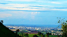
Ribeirão Preto
| Ribeirão Preto | ||
|---|---|---|
|
Coordinates: 21 ° 11 ′ S , 47 ° 49 ′ W Ribeirão Preto on the map of Sao Paulo
|
||
| Basic data | ||
| Country | Brazil | |
| State | São Paulo | |
| City foundation | 1856 | |
| Residents | 658,059 (2014) | |
| City insignia | ||
| Detailed data | ||
| surface | 651 km 2 | |
| Population density | 861 inhabitants / km 2 | |
| height | 600 m | |
| Time zone | UTC −3 | |
| City Presidency | Dárcy Vera | |
| Website | ||
| Ribeirao Preto center | ||
Ribeirão Preto is a city in the state of São Paulo in Brazil with 658,059 inhabitants (as of 2014), 313 kilometers north of the city of São Paulo .
It has become the largest sugar and alcohol producer in the world. The sugar cane plantations cover the entire district. Ribeirão Preto also has a prominent position in the export of organic products.
The tourist infrastructure (hotels, shops, bars, restaurants) and nightlife in the city are excellent. Famous are the Choperia Pinguim brewery and the Pedro II theater, which was founded on October 8, 1930, in the center of the city.
Ribeirão Preto has an international airport , which is served by national airlines. It is also the home airport of the Passaredo Linhas Aéreas .
Archdiocese of Ribeirão Preto
sons and daughters of the town
- David Picão (1923–2009), Bishop of Santos
- Émerson Leão (* 1949), football player and coach
- Celso Machado (* 1953), guitarist and composer
- Antonio Palocci (* 1960), politician
- William Bonner (* 1963), anchorman at TV Globo
- Raí (* 1965), football player
- Renata Lucas (* 1971), installation and concept artist
- Mestre Marcelo (* 1972), Capoeira master
- Alexandre Aleixo (* 1973), ornithologist and evolutionary biologist
- Marcelo Bordon (* 1976), football player
- Lucas Severino (* 1979), football player
- Diego (* 1985), soccer player
- Helder Mauricio da Silva Ferreira (* 1988), football player
- Willian (* 1988), soccer player
- Carlos Eduardo de Oliveira Alves (* 1989), football player
- Gilson César Santos Alves (* 1990), football player
- Léo Jardim (* 1995), football player
- Matheus Sávio (* 1997), football player
Web links
Commons : Ribeirão Preto - collection of images, videos and audio files


