
Rinerhorn
| Rinerhorn | ||
|---|---|---|
 Leidbachhorn, Marchhüreli and Rinerhorn (from left to right), taken from Davos |
||
| height | 2528.1 m above sea level M. | |
| location | Canton of Graubünden , Switzerland | |
| Mountains | Albula Alps | |
| Dominance | 0.473 km → Marchhüreli | |
| Notch height | 33 m ↓ degrees, 200 m south of the summit | |
| Coordinates | 781 525 / 179220 | |
|
||
| Development | Rinerhorn ski area on the western flank | |
 Summit from the Rinerhorn, Davos can be seen in the background |
||

The Rinerhorn is 2528 m above sea level. M. high mountain in the Albula Alps in the Swiss canton of Graubünden . The Rinerhorn ski area is located on the western flank and on the northern ridge . The name Rinerhorn can be traced back to the fact that the Landwasser valley river, like other streams in the area, was originally called the Rin (Rhine).
Location and surroundings
The Rinerhorn is bordered in the west by the Landwassertal and in the east by the Sertig valley , the streams of which flow together on the northern slope of the mountain. It is completely located in the municipality of Davos . The Horn forms the northern tip of a mountain ridge that stretches from south to north. In the south, neighboring mountains are Marchhüreli ( 2578 m above sea level ) and Leidbachhorn ( 2908 m above sea level ), the 3006 meter high Älplihorn and, further along the ridge, the Chrachenhorn at 2891 meters above sea level. Neighboring places in the north are Davos, about eight kilometers away as the crow flies , in the west, directly below the Horn, the Glaris settlement and in the east Sertig Valley the place Sertig Dörfli . A frequent starting point for climbing the summit is the mountain station of the gondola lift (Stn. Jatzmeder-Rinerhorn).
Development
There has been a ski area on the eastern slopes of the Rinerhorn since the 1960s, which is operated by the Rinerhorn mountain railways . It reaches up to a height of 2492 meters on the Nüllischgrat . In addition to the Rinerhornbahn (gondola lift) there are four tow lifts. It is part of the Davos Klosters Mountains winter sports area .
Routes to the summit

Since the Rinerhorn is covered on all sides with forest and grass surfaces, an ascent does not present any difficulties. Marked hiking trails open up the mountain peak from Glaris ( 1455 m above sea level ) in 3½ hours or from the cable car mountain station Jatzmeder of the Rinerhornbahn ( 2053 m above sea level ) in 1½ hours. According to the guide, the view from the Rinerhorn down into the Davos Valley should be “magnificent”.
panorama

gallery
Hubel mountain station on the north ridge.

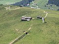
Stn. Jatzmeden-Rinerhorn and Juonli mountain station on the west flank.

Nüllisch mountain station in the south of the Rinerhorn.

View of Davos.

View to the north to the Jakobshorn.

Looking south to Marchhüreli and Leidbachhorn.


Literature and map
- Swiss Alpine Club (Ed.): Manfred Hunziker: Club Guide Bündner Alpen 6 - vom Septimer zum Flüela , 3rd edition 2000, ISBN 3-85902-187-7
- National map of Switzerland 1: 25,000, sheet 1217, Scalettapass
Web links
- Panorama from the Rinerhorn
- www.hikr.org Tour reports