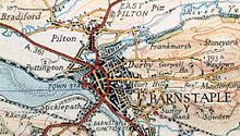
River Taw
| River Taw | ||
|
Barnstaple Long Bridge |
||
| Data | ||
| location | England , UK | |
| River system | River Taw | |
| River basin district | South West RBD | |
| source | On the western slope of Hangingstone Hill, 50 ° 39 ′ 23 " N , 3 ° 58 ′ 7" W |
|
| Source height | approx. 550 m ASL | |
| muzzle | West of Barnstaple on Bideford Bay , Bristol Channel Coordinates: 51 ° 4 ′ 22 " N , 4 ° 13 ′ 21" W 51 ° 4 ′ 22 " N , 4 ° 13 ′ 21" W |
|
| Mouth height | 0 m ASL | |
| Height difference | approx. 550 m | |
| Bottom slope | approx. 7.6 ‰ | |
| length | 72 km | |
| Medium-sized cities | Barnstaple | |

The River Taw is a 72 kilometer long river that has its source at Taw Head on the central-north flanks of Dartmoor . It flows into the Bristol Channel on the north coast of Devon immediately after it has already taken up the Torridge from its left side in the estuary .
course
The river has its source on the western slope of the 183 m high Hangingstone Hill at approx. 168 m and flows mainly in a northerly direction. At the beginning he gave his name to the village of South Tawton and later to North Tawton and Taw Green . In its course it takes on a number of smaller tributaries, all of which arise in the headwaters of Dartmoor , further seaward also the Exmoor , including the Lapford Yeo , Little Dart River and Mole . These tributaries all flow from the right because the Torridge, which flows parallel to the left of the Taw, does not allow any larger tributaries. From Newbridge, which is 19 kilometers from the sea, it becomes tide-dependent . Shortly after Barnstaple , the almost three-kilometer-long Yeo flows out , which also has different water levels caused by the tides.
On its way to the sea, the River Taw is crossed after 15 kilometers by the four-lane A 30 , six kilometers later on a shared bridge also by the B3072 and B3124. Shortly after the village of Coldridge (km 28) the river runs parallel to the A377 and the Tarka line railway to Barnstaple and is crossed several times by both.
Mouth funnel
The estuary begins at Newbridge. There the river is about 20 meters wide. In the estuary the distance from bank to bank is about 750 meters. The tidal range is about six meters on its last section.
Importance of the river
Apart from Barnstaple with around 34,000 inhabitants and its current suburb of Newbridge, there are no significant settlements along the river. Nonetheless, its valley is an important traffic axis for both road and rail. The River Taw is almost always accompanied by both, sometimes on its right bank, sometimes on its left bank. There is no shipping traffic on the river itself above Barnstaple Long Bridge .
Both a railway company, namely the "Taw Vale Railway and Dock Company" and the line "Taw Vale Railway", a branch of the "North Devon Railway", owe their names to the Taw. The town of Barnstaple has always been an important trading center, but the attractiveness of the railway has been made even more attractive.
In addition to the Long Bridge, which has its origins in the Middle Ages, another bridge crosses the River Taw before it flows into the sea: the long-awaited “Downstream Bridge”, part of the Barnstaple Western Bypass .
Far out in the estuary, the long sandbank of Braunton Burrows blocks shipping to the ports of Barnstaple, Fremington, Instow and Bideford.
Fremington was the most important transshipment port between Bristol and Lands End, especially in the mid-19th century, especially for Welsh coal, which only had to be transported a short distance across the Bristol Channel and was transported from here by rail. The last Taw harbor before the sea is Yelland . Between 1955 and 1984 there was a coal-fired power station, which was demolished in 1989, but the port is still used today for the transshipment of petrochemical goods, especially crude oil. There are some oil tanks at this point .
Web links
- Tide table Taw estuary
- Environment Agency: Taw and North Devon Streams Catchment Abstraction Management Strategy. Map page 6 (PDF file; 1.19 MB)
swell
- ↑ http://www.swehs.co.uk/docs/news28su.html#55 Homepage of the South Western Electricity Historical Society

