River Thame
| River Thame | ||
|
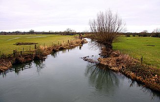
The River Thame as the border between Buckinghamshire and Oxfordshire |
||
| Data | ||
| location | Buckinghamshire , Hertfordshire , Oxfordshire , England | |
| River system | Thames | |
| Drain over | Thames → North Sea | |
| source | south of Cheddington 51 ° 50 ′ 27 ″ N , 0 ° 41 ′ 44 ″ W. |
|
| muzzle | south of Dorchester in the Thames Coordinates: 51 ° 38 ′ 6 ″ N , 1 ° 10 ′ 0 ″ W 51 ° 38 ′ 6 ″ N , 1 ° 10 ′ 0 ″ W
|
|
| length | 95.6 km | |
| Catchment area | 206.811 km² | |
| Left tributaries | Dad Brook , Cuttle Brook (north) , Cuttle Brook (south) , Haseley Brook | |
| Right tributaries |
Thistle Brook , Holton Brook , Cuddesdon Brook , Baldon Brook |
|
| Medium-sized cities | Aylesbury , Dorchester | |
| Small towns | Thame | |
| Communities | Drayton St Leonard , Shabbington , Chearsley , Nether Winchendon , | |
The River Thame is a river in England . The Thame rises south of Cheddington in Buckinghamshire . It flows after its formation in a westerly direction for a short distance through Hertfordshire and then again through Buckinghamshire, where it runs north of Aylesbury . To the west of Aylesbury it turns in a more south-westerly direction. From the northern edge of Thame to east of Waterperry it forms the border of Buckinghamshire and Oxfordshire . Just before it flows into the Thames, it flows east of Dorchester .
Web links
Commons : River Thame - collection of images, videos and audio files
Individual evidence
- ↑ a b Thame (Scotsgrove Brook to Thames) on Environment Agency Catchment Data Explorer, accessed January 27, 2017
- ↑ a b Thame (Aylesbury to Scotsgrove Brook) on Environment Agency Catchment Data Explorer, accessed January 27, 2017
- ↑ a b Thame upstream of Aylesbury on Environment Agency Catchment Data Explorer, accessed January 27, 2017
