Rosenbach saddle
| Rosenbach Saddle ( Rožca ) | |||
|---|---|---|---|
|
Rosenbach saddle from the southeast |
|||
| Compass direction | North | south | |
| Pass height | 1586 m above sea level A. | 1587 m. i. J. | |
| region | State of Carinthia , Austria | Jesenice municipality , Slovenia | |
| Watershed | Bear pit → Rosenbach → Drau → Danube | Rates → Svobodni potok → Sava Dolinka → Danube | |
| Valley locations | Sankt Jakob im Rosental | Jesenice | |
| expansion | trail | ||
| Mountains | Karawanken | ||
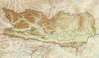
| Map (Carinthia) | |||
|
|
|||
| Coordinates | 46 ° 28 '53 " N , 14 ° 1' 11" E | ||
The Rosenbachsattel ( Slovenian Rožca ) is a 1587 m. i. J. high mountain pass in the Karawanken on the border of the federal state Carinthia , municipality Sankt Jakob im Rosental , in Austria and the municipality Jesenice (statistical region Gorenjska ) in Slovenia .
description
The Rosenbachsattel is rich in mountain flowers and is located directly above the railway Karawanken tunnel between the two peaks Rosenkogel ( Hruški vrh ) 1776 meters and Hahnkogel ( Klek ) 1753 meters. At the top of the saddle there is a view of the 15 km long Mežakla plateau in Slovenia. The Mokotova Bajta hut is located a few meters below the saddle on the south side of Slovenia .
The Rosenbachsattel forms the watershed between the Drava in Carinthia, over which it drains northwards via the Bärengraben and the Rosenbach, and the Save in Slovenia, into which it drains via the Raten and Svobodni potok brooks. The Drava flows into the Save.
Individual evidence
- ↑ a b Rožca. Retrieved November 22, 2019 .
- ↑ Bear pit on Kagis
- ↑ Rožca on Geopedia.si

