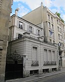
Rue Mesnil (Paris)
Coordinates: 48 ° 52 ' N , 2 ° 17' E
| Rue Mesnil | |
|---|---|
| location | |
| Arrondissement | 16. |
| quarter | Porte Dauphine |
| Beginning | 7, Place Victor-Hugo |
| The End | 52, rue Saint-Didier |
| morphology | |
| length | 255 m |
| width | 10 m |
| history | |
| Emergence | 1834 |
| designation | 1834 |
| Coding | |
| Paris | 6204 |
The Rue Mesnil is a 255 meter long and 10 meter wide street in the neighborhood Porte Dauphine of the 16th arrondissement of Paris .
location
The street starts at Place Victor Hugo and ends at Rue Saint-Didier .
The street can be reached by metro via Victor Hugo station .
![]()
![]()
Name origin
The name "Mesnil" is derived from the Latin mansio (place of residence, place, hamlet); therefore this was probably the municipal road .
history
The road was laid out in the municipality of Passy in 1856 and added to the Paris road network in 1863.
Attractions
- No. 5: The house of today's café Le Petit Retro was built in 1920 and was declared a monument historique in 1984 .
- No. 8: The house, built in 1936 by the architect Robert Mallet-Stevens (1886–1945), serves as a fire station and was declared a monument historique in 1986 .
Web links
Commons : Rue Mesnil - Collection of images, videos and audio files
Individual evidence
- ↑ Entry no. PA00086665 in the Base Mérimée of the French Ministry of Culture (French)
- ↑ Entry no. PA00086666 in the Base Mérimée of the French Ministry of Culture (French)


