Rydelek ice falls
| Rydelek ice falls | ||
|---|---|---|
|
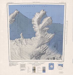
Topographic map (1: 250,000) of the Martin Peninsula with the Rydelek Icefalls (right of center) |
||
| location | Marie Byrd Land , West Antarctica | |
| Coordinates | 74 ° 27 ′ S , 113 ° 54 ′ W | |
|
|
||
| drainage | Dotson Ice Shelf | |
The Rydelek Icefalls are glacier breaks on the Walgreen Coast of Marie Byrd Land in West Antarctica . They lie between the Smythe Shoulder and the Coyer Point on the east side of the Martin Peninsula and flow into the Dotson Ice Shelf .
The United States Geological Survey mapped them based on their own measurements and aerial photographs of the United States Navy from 1959 to 1967. The Advisory Committee on Antarctic Names named them in 1977 after the geophysicist Paul Anthony Rydelek (* 1949) of the University of California, Los Angeles , who was part of the United States Antarctic Research Program about the cast at the Amundsen-Scott South Pole Station in the Antarctic winter of 1974.
Web links
- Rydelek Icefalls in the Geographic Names Information System of the United States Geological Survey (English)
- Rydelek Icefalls on geographic.org (English)

