Söderköping
| Söderköping | ||||
|
||||
| State : | Sweden | |||
| Province (län): | Östergötland County | |||
| Historical Province (landskap): | Östergötland | |||
| Municipality : | Söderköping | |||
| Coordinates : | 58 ° 29 ′ N , 16 ° 20 ′ E | |||
| SCB code : | 1284 | |||
| Status: | Crime scene | |||
| Residents : | 7418 (December 31, 2015) | |||
| Area : | 5.05 km² | |||
| Population density : | 1469 inhabitants / km² | |||
| List of perpetrators in Östergötland County | ||||
Söderköping is a city in the Swedish province of Östergötland County and the historic province of Östergötland . The city on the Göta Canal is located about 15 kilometers southeast of Norrköping on European route 22 and is the capital of the municipality of the same name .
history
Söderköping is a medieval Swedish city that was first mentioned in written sources in the 13th century. Archaeological finds, however, indicate an older settlement. From the 13th century to the end of the 16th century, Söderköping was one of the leading Swedish ports for national and international trade with important contacts to the Hanseatic League and a center of power in Sweden. 1302 King Birger Magnusson was crowned in Söderköping and Johan III. had a house built for himself in the city. But the Scandinavian land uplift meant that the port was no longer navigable for larger ships from the end of the 16th century. Söderköping became less important and only about 700 people lived in the city in the 18th century. At the beginning of the 19th century Söderköping became a health resort . The industrial development of the 19th century largely passed Söderköping by.
Cityscape
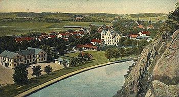
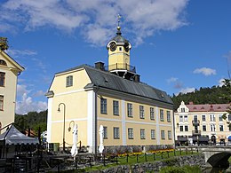
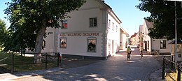
Söderköping is one of the best preserved medieval cities in Sweden. Apart from the medieval buildings like the St. Laurentius Church or the house of Johans III. Wooden houses from the 18th and 19th centuries dominate the city center. The spa complex from the beginning of the 19th century, when Söderköping became known as a spa town, is located southeast of the center. The Göta Canal runs on the northern edge of the city at the foot of the Ramunderberg.
economy
Söderköping has little industry and mostly small businesses. The city is mainly a service center for the region, but tourism also plays an important role. Not only the medieval city center , also the Göta Canal and the coastal location with the numerous offshore archipelago contribute to this.
Web links
- Official website of the municipality of Söderköping (German, English, Swedish)
Individual evidence
- ↑ a b Statistiska centralbyrån : Land area per Tatort, folkmängd and invånare per square kilometer. Vart femte år 1960 - 2015 (database query)


