
Südpark (Erfurt)
The South Park has 7 hectares of a medium-sized park of the city of Erfurt . It is located in the historic Löbervorstadt and emerged from the Erfurt Südfriedhof, which closed in 1978 . Its area has, however, shrunk to less than half as a result of development in the north and south, especially due to the SED district party school and the building of the Erfurt sports center . The park has trees that are over 100 years old and two memorials from the time of the cemetery.
location
The Südpark is now delimited as a square by Friedrich-Ebert-Straße in the east, Mozartallee along the Steigerwaldstadion in the west, by development on Johann-Sebastian-Bach-Straße in the north and the "Alte Parteischule" and the sports high school in the south ( see coordinates above right).

history
The cemetery
The south cemetery was laid out from 1871 to 1876 "far from the city" in what was then Löberfeld as an "outside cemetery" for Erfurt, which was then rapidly growing, and opened in 1871. In 1877 it covered 13 hectares and reached from Johann-Sebastian-Bach-Strasse in the north to Schützenhaus-Strasse (today Werner-Seelenbinder-Strasse) in the south. In 1875 a funeral and ceremony hall was built. In 1873, the enclosure began with a wall along Epinay-Strasse (today Friedrich-Ebert-Strasse) in the east and was completed in 1896 in the north. A total of 75,000 deceased were buried in the south cemetery from 1871 to 1956. This included important Erfurt personalities: the military, merchants, gardeners, industrialists, people active in art and science and their families. Accordingly, the cemetery also had many artistically valuable grave monuments. With its rich stock of trees and bushes, it was rated as “one of the most beautiful cemeteries in Central Germany” and “one of the most beautiful fields of God in all of Germany”. The resting place was "like a solemn dome". Due to a lack of space in the south cemetery, the main cemetery in Erfurt was laid out on Binderslebener Landstrasse from 1913 to 1916 . In 1923 a crematorium with a new celebration hall was inaugurated in the south cemetery. From 1936 onwards only urn burials were permitted on it.
On February 24, 1944, a shot down German Me 110 fighter plane crashed into the Südfriedhof and destroyed 50 graves. On the night of November 26th to 27th, 1944, a British mine bomb detonated in the South Cemetery and the crematorium was damaged.
The park
As early as the mid-1930s, the Erfurt magistrate estimated that “the south cemetery will later become a magnificent park”. In 1956 the cemetery was closed and after 20 years it should be converted into a park. The tombstones were removed, the burial mounds leveled, the solid wall on Friedrich-Ebert-Straße torn down and the lush stock of shrubs and trees heavily thinned (chestnuts, maples, poplars, linden trees, oaks, beeches and pines). “The Polish Cenotaph and the Memorial to the Bomb Victims will remain committed to the care of all”. "Some time ago the SED took part of the Place of the Dead for itself and built its district party school there" (1969 to 1971). The cemetery was closed in 1978, and the simple park was laid out in the middle part of it (about half of the original area) from 1970. The network of paths from the cemetery era remained largely unchanged. The well-preserved crematorium (worked until 1977) with the celebration hall was demolished in 1978. All gravestones, including important grave monuments, have been removed. In the vicinity of the SED party school, there should be nothing more of the past than a cemetery.
In the north of the cemetery there was a market garden on Johann-Sebastian-Bach-Strasse, and to the northeast on Friedrich-Ebert-Strasse there was a small pharmaceutical factory. This burned down for unknown reasons in the 1970s. The area was built on during the GDR era and after the fall of the Wall .
The only remaining building from the cemetery era is a clinker brick building in the center of the park, which serves as a residential building and training center for aspiring landscape gardeners. The building is surrounded by a small, fenced garden. The demolished crematorium had been to the east of it and almost reached Friedrich-Ebert-Strasse.
In the north-western area of the park there is now a "South Park Adventure Playground". Fenced in into the park, there are ugly and smeared low-rise buildings in the vicinity of the stadium. The remaining bushes and shrubs in the park were removed in 2013/2014. Since then the songbirds have become correspondingly rare or have disappeared completely.
At the end of the 1970s, there were considerations to build a congress center in the Südpark. The shell of the building was then built at the end of the 1980s on the Hirschgarten , the then "Place of German-Soviet Friendship", in the center of Erfurt - where it was dismantled again after the "Wende".
Memorials
- War cemetery for German dead from March / April 1945: A stone slab shows the inscription: "Here lie bomb victims of spring 1945". 37 granite crosses were erected over a burial ground by the Volksbund Deutsche Kriegsgräberfürsorge , each of which bears three names. The dates of birth and death are not visible for all 108 dead, some of them also weathered. 60% are men, 40% women, no children (?). Almost half of the victims died on March 30th and 31st, 1945 (American bombing raids on Erfurt), about a quarter on April 10th and 12th, 1945 (artillery fire, low-level aircraft, capture of the city by US troops), just under a quarter a given date of death after the occupation in the course of April (perhaps some deaths found later).
- Memorial for Polish victims: memorial inscription: “Here rest Polish nationals who died in fascist camps” (on both sides there are panels with around 170 names and reference to 118 persons unknown by name). During the GDR era only the middle memorial stone stood here. The current, fenced-in facility was designed after the fall of the Wall .
The restored German grave and memorial site was re-inaugurated in 1995 by the Volksbund Deutsche Kriegsgräberfürsorge. Since 2019 there has been an information board next to the graves about the events in March and April 1945 in Erfurt, classified according to the historical context. It was designed by students from two Erfurt high schools, supervised by the Volksbund Thuringia.
photos

Last building from the time of the cemetery: house and training center

German war cemetery 1993

German war cemetery from 1995 (2017)

German war cemetery from 1995 (2015)

Polish memorial
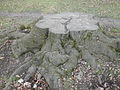
Old beech stump in the park


literature
- Karl-Heinz Lohfeld: Erfurt cemeteries - then and now . Erfurt Heimatbrief No. 6, June 1963. pp. 49–51
- Change in the south cemetery (half-yearly gazette). Erfurt Heimatbrief No. 26, June 1973. pp. 28-29
- Ruth Menzel: The former Erfurt Südfriedhof - today Südpark . City and history, magazine for Erfurt. Special issue No. 9, 2008. pp. 12–15
Individual evidence
- ↑ Ruth Menzel: The former Erfurt Südfriedhof - today Südpark . SuG special issue 9, 2008, pp. 13/14
- ↑ Helmut Wolf: Erfurt in the air war 1939-1945 . Glaux-Verlag, Jena 2005. P. 127, 156
- ↑ Change in the south cemetery . Erfurt Heimatbrief No. 26, June 1973. P. 28/29
- ↑ http://www.volksbund.de/kriegsgraeberstaette/erfurt-suedpark.html
Web links
Coordinates: 50 ° 57 '38.8 " N , 11 ° 2' 26.4" E