Saire
| Saire | ||
|
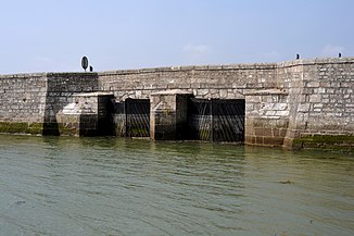
Lock bridge over the Saire at its mouth |
||
| Data | ||
| Water code | FR : I63-0400 | |
| location | France , Normandy region | |
| River system | Saire | |
| River basin district | FRH / Seine - Normandy | |
| source | in the municipality of Le Mesnil-au-Val 49 ° 35 ′ 37 ″ N , 1 ° 32 ′ 45 ″ W |
|
| Source height | approx. 150 m | |
| muzzle | just south of Réville in the English Channel Coordinates: 49 ° 36 ′ 31 ″ N , 1 ° 14 ′ 49 ″ W 49 ° 36 ′ 31 ″ N , 1 ° 14 ′ 49 ″ W |
|
| Mouth height | 0 m | |
| Height difference | approx. 150 m | |
| Bottom slope | approx. 4.8 ‰ | |
| length | 31 km | |
| Catchment area | 125 km² | |
|
Waterfall near Le Vast |
||
The Saire is a coastal river in France that runs in the Manche department in the Normandy region . It rises in the municipality of Le Mesnil-au-Val , drains generally in an easterly direction and flows into the English Channel after 31 kilometers at Réville , north of Saint-Vaast-la-Hougue . The river is also the namesake for the Val de Saire landscape of the same name , which is seen more spacious than the actual course of the river.
Places on the river
Attractions
- Artificially created waterfall near Le Vast
See also
Web links
Commons : Saire - collection of images, videos and audio files

