Sairecabur
| Sairecabur | ||
|---|---|---|
|
View from the west |
||
| height | 5980 m | |
| location | Region Antofagasta , Chile / Departamento Potosí , Bolivia | |
| Mountains | To the | |
| Dominance | 69.42 km → Acamarachi (Cerro Pili) | |
| Notch height | 0 m | |
| Coordinates | 22 ° 43 '48 " S , 67 ° 52' 48" W | |
|
|
||
| Type | Stratovolcano | |
| Normal way | On the Chilean side, a road leads over the crater itself to an old sulfur mine, from where the ascent can begin. | |
| particularities | 360 ° panoramic view from the summit | |
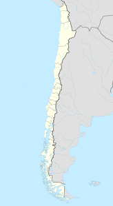
Sairecabur is a stratovolcano in the Cordillera Occidental on the border between Chile and Bolivia on the edge of the Atacama Desert . The highest point is about 5980 m high and is located on the edge of the caldera, which extends about 4.5 km in north-south direction . The closest place is San Pedro de Atacama . In the north of the Sairecabur lies the Escalante volcano .
In the caldera itself there is a radio telescope ( Receiver Lab Telescope (RLT)) and an old sulfur mine, both of which can be reached by road. The ascent to the summit also begins from this point. The ascent goes up to the summit over large angular stones that require easy climbing. The special feature is the all-round view that you have from the summit. The Licancabur can also be seen very well from here.
Agencies in San Pedro de Atacama offer guided tours to the summit.
photos
Web links
- Sairecabur in the Global Volcanism Program of the Smithsonian Institution (English)
- Description of the ascent of Sairecabur
- Pictures from a tour to the mountain


