Salaverry (Peru)
| Salaverry | ||
|---|---|---|
|
|
||
| Coordinates | 8 ° 13 ′ S , 78 ° 59 ′ W | |
| Basic data | ||
| Country | Peru | |
| La Libertad | ||
| province | Trujillo | |
| ISO 3166-2 | PE-LAL | |
| District | Salaverry | |
| height | 3 m | |
| Residents | 11,751 (2017) | |
| founding | March 9, 1870 | |
| Website | munisalaverry.gob.pe (Spanish) | |
| politics | ||
| mayor | Mónica Betancourt (2019-2022) |
|
| Political party | Alianza para el Progreso | |
|
Aerial view of Salaverry
|
||
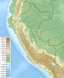
Salaverry is a port city on the Pacific coast of northwest Peru in the La Libertad region . Salaverry is 13 km southeast of Trujillo city center . The national road 1N ( Panamericana ) runs 2.5 km north of the city. The population was 11,751 in the 2017 census. 10 years earlier the population was 8,816. The city is the administrative seat of the district of the same name .
port
The port of Salaverry has two piers that also serve as breakwaters . One is 225 m long and 25 m wide, the second is 230 m long and 30 m wide. The concession to operate the port was awarded to Transportadora Salaverry (Grupo Romero) in 2018. The port is also used by cruise ships. In 2018, only 40 container equivalents ( TEU ) were handled.
Individual evidence
- ↑ a b PERU: La Libertad Region - Provinces & Places . www.citypopulation.de. Retrieved February 3, 2020.
- ↑ Datos estadísticos del Informe de la actividad portuaria de América Latina y el Caribe 2018 (PDF, 349 KB) Naciones Unidas, CEPAL - DIVISIÓN DE COMERCIO INTERNACIONAL E INTEGRACIÓN. Retrieved February 4, 2020.
Web links
Commons : Salaverry - collection of images, videos and audio files


