Saltelva
|
Saltelva Saltdalselva |
||
|
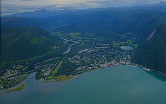
Mouth of the Saltelva |
||
| Data | ||
| Water code | NO : 163.Z | |
| location | Saltdal in Nordland ( Norway ) | |
| River system | Saltelva | |
| Drain over | Saltelva → Atlantic Ocean | |
| muzzle |
Saltdalsfjord near Rognan Coordinates: 67 ° 6 ′ 23 " N , 15 ° 25 ′ 28" E 67 ° 6 ′ 23 " N , 15 ° 25 ′ 28" E |
|
| Mouth height |
0 m
|
|
| length | 78.1 km | |
| Catchment area | 1,542.27 km² | |
| Drain |
MQ |
50.94 m³ / s |
| Communities | Rognan | |
| Navigable | No | |
The Saltelva (also Saltdalselva ) is a river in the municipality of Saltdal in the Norwegian province of Nordland . It rises in Saltfjell , flows through the Saltdal valley and flows into the Saltdalsfjord at Rognan , a branch of the Skjerstadfjord , which in turn is the continuation of the Saltfjord . The river is 78.1 km long and has a catchment area of 1542.27 km². The mean flow rate at the mouth is 50.94 m³ / s.
The European route 6 and the Nordlandsbanen railway line run along the Saltelva in Saltdal .
Individual evidence
- ↑ a b NVE Atlas ( Memento of the original from March 6, 2011 in the Internet Archive ) Info: The archive link was inserted automatically and has not yet been checked. Please check the original and archive link according to the instructions and then remove this notice. , Norges vassdrags- og energidirektorat
