Savage-Guilford
| Savage-Guilford | ||
|---|---|---|
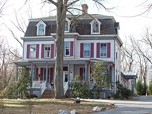
 Savage Mill Manor House |
||
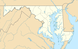
| Location in Maryland | ||
|
|
||
| Basic data | ||
| State : | United States | |
| State : | Maryland | |
| County : | Howard County | |
| Coordinates : | 39 ° 9 ′ N , 76 ° 49 ′ W | |
| Time zone : | Eastern ( UTC − 5 / −4 ) | |
| Residents : | 12,918 (as of: 2000) | |
| Population density : | 1,009.2 inhabitants per km 2 | |
| Area : | 12.9 km 2 (approx. 5 mi 2 ) of which 12.8 km 2 (approx. 5 mi 2 ) are land |
|
| Height : | 124 m | |
| Postcodes : | 20723, 20724, 20794, 21046 | |
| Area code : | +1 240, +1 301 | |
| FIPS : | 24-70487 | |
| GNIS ID : | 1710126 | |
Savage-Guilford was a place ( CDP ) in Howard County in the US state of Maryland in the United States at the 2000 census . The place is between Baltimore and Washington, DC and included the two unincorporated communities Savage and Guilford .
Savage-Guilford was bounded in the south by the route of the power lines , which run from the High Ridge Substation
to the southeast. To the west, the Interstate , the Patuxent Freeway north of I-95 and a small stream west of Guilford formed the border. To the north and east, the CSX industrial track and Washington Boulevard formed the border.
![]()
![]()
![]()
![]()
For the 2010 census , the area was redistributed: Guilford, north of I-95, was assigned to Columbia , the area between the Little Patuxent River and the route of the power lines became the new North Laurel , while the old, much larger and further south, North Laurel became Scaggsville . The new Savage now only covers the area between the Little Patuxent River, I-95, the industrial track to Guilford and Washington Boulevard.
Personalities
- William Bowie (1872-1940), surveyor
- Benny Mardones (1946-2020), singer and songwriter
Individual evidence
- ↑ Savage in the United States Geological Survey's Geographic Names Information System , accessed March 16, 2014
