Sawala
|
Sawala Савала́ |
||
|
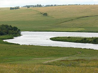
Savala near Novochopjorsk |
||
| Data | ||
| Water code | RU : 05010200312107000007072 | |
| location | Oblast Tambov , Voronezh Oblast ( Russia ) | |
| River system | Don | |
| Drain over | Chopjor → Don → Black Sea | |
| source | in the Oka-Don plain 52 ° 16 '16 " N , 41 ° 59' 21" E |
|
| muzzle |
Chopjor coordinates: 51 ° 2 ′ 47 " N , 41 ° 40 ′ 41" E 51 ° 2 ′ 47 " N , 41 ° 40 ′ 41" E
|
|
| length | 285 km | |
| Catchment area | 7720 km² | |
| Discharge at the gauge near the mouth |
MQ |
20 m³ / s |
| Right tributaries | Burnatschka , Jelan | |
| Small towns | Sherdevka | |
The Sawala ( Russian Савала́ ) is a right tributary of the Chopjor in the Russian oblasts of Tambov and Voronezh .
The Sawala has its origin in the Oka-Don Plain in the Tambov Oblast. It flows mainly in a southerly direction into the Voronezh Oblast. The Sawala passes the small town of Scherdewka . After 285 km south of Novochopjorsk, it joins the Chopjor on the right. The catchment area covers 7720 km². The river is mainly fed by the snowmelt . Every year in April, the Sawala floods . The mean discharge (MQ) at the mouth is 20 m³ / s. The river is ice-covered between late November and late March. The most important tributary of the Sawala is the Jelan .
