Schirnbach
| Schirnbach | ||
|
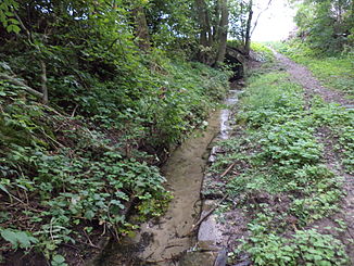
The Schirnbach shortly after its source |
||
| Data | ||
| Water code | DE : 243222 | |
| location |
Steigerwald
|
|
| River system | Rhine | |
| Drain over | Sambach → Castellbach → Schwarzach → Main → Rhine → North Sea | |
| origin |
Schirnbach spring southeast of Rüdenhausen 49 ° 45 ′ 35 ″ N , 10 ° 20 ′ 42 ″ E |
|
| Source height | approx. 266 m above sea level NHN | |
| muzzle | Northwest of Feuerbach in the Sambach Coordinates: 49 ° 47 '18 " N , 10 ° 17' 46" E 49 ° 47 '18 " N , 10 ° 17' 46" E |
|
| Mouth height | approx. 216 m above sea level NHN | |
| Height difference | approx. 50 m | |
| Bottom slope | approx. 6.9 ‰ | |
| length | 7.3 km with Goldbach from its usual source | |
| Catchment area | 22.76 km² | |
The Schirnbach is a left and southeast tributary of the Sambach between the Maindreieck and Steigerwald in Lower Franconia .
geography
Schirnbach spring
The Schirnbach spring, designated as a natural monument , lies at an altitude of about 266 m above sea level. NHN southeast of Rüdenhausen . The water of the spring set in natural stones rises from the rocks of the Steigerwald foreland and emerges from the sand-covered soil of the spring socket.
The Rüdenhausen bypass is currently being built near the Schirnbach spring .
course
The Schirnbach, which soon runs steadily north-west, is strengthened for the first hundred meters after the source, first on the left and then on the right by two only periodically flowing streams; the longer right one along the St 2421 is called Goldbach and usually arises half a kilometer south-east of the Rüdenhausen outskirts of a source in a small wood, but can sometimes even arise on the outskirts of Greuth .
In Rüdenhausen, the Schirnbach initially flows along the eastern edge of the castle park, where it used to feed the moat of Rüdenhausen Castle . After the market place, he takes a shorter source branch of the same name from the left on the A 3 crossing between Loh- and Kratzermühle. Down the Kratzermühle, the Schoßbach flows from the right, which, together with its upper reaches, the Kantersbach, is even longer than the Schirnbachstrang up to this point; a little after this mill, also from the east-southeast, the equally long Heimbach or Heubach. The stream then crosses a forest bar and in the following corridor the village of Feuerbach .
Below it it finally flows out at an altitude of about 216 m above sea level. NHN at the lower paper mill from the left into the Sambach .
Its approximately 7.3 km long run ends 50 meters below its source, so it has an average bed gradient of 6.9 ‰.
Tributaries
- Goldbach (right, shortly after the source)
- Schirnbach (left)
- Schossbach (right)
- Heimbach or Heubach (right)
Schwarzach river system
See also
Web links
- Map of the course and catchment area of the Schirnbach on: BayernAtlas of the Bavarian State Government ( information )
Individual evidence
- ↑ a b Height queried (with a right click) on: BayernAtlas of the Bavarian State Government ( information )
- ↑ a b List of brook and river areas in Bavaria - Main river area, page 72 of the Bavarian State Office for the Environment, as of 2016 (PDF; 3.3 MB)

