Canow lock
| Canow lock | ||
|---|---|---|
|
Canow lock |
||
| location | ||
|
|
||
| Coordinates | 53 ° 11 '57 " N , 12 ° 54' 14" E | |
| Country: |
|
|
| Place: | Wustrow OT Canow | |
| Waters: | Müritz-Havel waterway | |
| Water kilometers : | km 9.50 | |
| Data | ||
| Owner: | Federal waterways and shipping administration | |
| Responsible WSA : | Eberswalde | |
| lock | ||
| Type: | Inland lock | |
| Is controlled by: | served on site | |
| Usable length: | 41.50 m | |
| Usable width: | 5.40 m | |
| Height upstream : | 57.5 m above sea level NHN | |
| Average height of fall : |
1.30 m | |
| Upper gate: | Miter gate | |
| Lower gate: | Miter gate | |
| Others | ||
| Was standing: | November 2016 | |
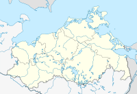
The Canow lock is an inland lock in the Müritz-Havel waterway . Responsibility lies with the Canow suburb of the Eberswalde Waterways and Shipping Office . It lies between the Labussee and Canower See .
description
The first Canow lock was built in the mid-1830s. Between 1831 and 1837, the Strasen , Canow, Diemitz and Bolt locks were used to connect the waterway between the Havel in the Ellbogensee and the Müritz at Bolter Mühle . The Canow lock enables the different water levels between the Labussee and Canower See to be overcome . The average height of fall is 1.30 meters. The lock chamber can be used over a length of 41.60 m and a width of 5.30 m and is closed with mortise gates .
Since the boom in water tourism in the Mecklenburg Lake District , the Canow lock has been one of the most frequented in the region. The Canow lock is operated on site, and passenger and sport shipping can use it at certain times from mid-March to the end of November.
Web links
- WSA information page on the Canow lock , accessed on June 17, 2016.
- Information page of ABZ Canow , accessed on June 17, 2016.
- WSA Eberswalde: Lock dimensions , accessed on November 22, 2016
Footnotes
- ↑ Lock dimensions. WSA Eberswalde, accessed on June 17, 2016 .

