Mirow lock
| Mirow lock | ||
|---|---|---|
|
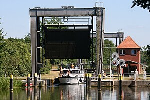
Mirow lock with the lifting gate open |
||
| location | ||
|
|
||
| Coordinates | 53 ° 16'20 " N , 12 ° 48'5" E | |
| Country: |
|
|
| Place: | Mirow | |
| Waters: | Müritz-Havel waterway | |
| Water kilometers : | km 22.3 | |
| Data | ||
| Owner: | Federal waterways and shipping administration | |
| Responsible WSA : | Eberswalde | |
| Construction time: | 1935-1936 | |
| Start of operation: | 1936 | |
| lock | ||
| Category: | Inland waterway class I | |
| Usable length: | 54.5 m | |
| Usable width: | 6.63 m | |
| Height upstream : | 61.99 m above sea level NN | |
| Average height of fall : |
2.98 m | |
| Upper gate: | Lift gate | |
| Lower gate: | Lift gate | |
| Others | ||
| Was standing: | June 2016 | |
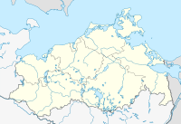
The Mirow lock is a boat lock on the Müritz-Havel waterway . It is located in Mirow in the south of the Mecklenburg Lake District .
description
The Mirow lock was built in 1935/36 together with the Mirow Canal . Both structures connect the small lake area of the Mecklenburg Lake District with the large lake area around the Müritz . For this reason, the lock is also known as the gateway to the Müritz .
The lock chamber consists of sheet pile walls and is closed with lifting gates. It can be used over a length of 54.40 m and a width of 6.63 m and has an average fall height of 2.98 m. The responsible waterways and shipping authority in Eberswalde operates the lock on site. The passenger and recreational boating can use them by the end of November at set times from mid-March.
Web links
Individual evidence
- ↑ Mirow lock. City of Mirow, accessed on June 19, 2016 .
- ↑ Lock dimensions. WSA Eberswalde, accessed on June 19, 2016 .
- ↑ Operating times of the Mirow lock. ELWIS , accessed November 27, 2017 .

