Seerau
|
Seerau
City of Hitzacker (Elbe)
Coordinates: 53 ° 7 ′ 43 " N , 11 ° 3 ′ 14" E
|
||
|---|---|---|
| Incorporation : | July 1, 1972 | |
| Postal code : | 29456 | |
| Area code : | 05862 | |
|
Location of Seerau in the Lüchow-Dannenberg district |
||

Seerau is a district of the town of Hitzacker (Elbe) in the Lüchow-Dannenberg district in Lower Saxony .
geography
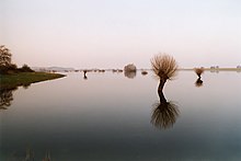
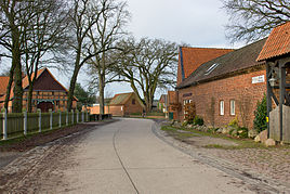
The place is 1 km south of the main town Hitzacker as a separate settlement. The eastern part with several agricultural farms is located on a hill-like elevation (approx. 12.5 m above sea level) in the valley of the Jeetzel , which here naturally belongs to the Elbe floodplain. To the west of the Hitzacker-Dannenberg railway line, the terrain rises towards the Hohe Geest des Drawehn and finally reaches up to 70 m in the west.
history
On July 1, 1972, the Seerau community was incorporated into Hitzacker together with the communities of Bahrendorf , Grabau, Harlingen , Kähmen, Nienwedel, Tießau, Wietzetze and Wussegel .
See also
- Seerau im Drawehn
- Seerau in the Lucie
- List of settlements in the Lüchow-Dannenberg district # Rundlingsdörfer
literature
- Wolfgang Jürries (ed.): Wendland-Lexikon , Vol 2, L-Z. . Series of publications of the local history working group Lüchow-Dannenberg Volume 13, 2008. ISBN 978-3-926322-45-6
Web links
- Photos from Seerau (Hitzacker) on wendland-archiv.de
Individual evidence
- ^ Federal Statistical Office (ed.): Historical municipality directory for the Federal Republic of Germany. Name, border and key number changes in municipalities, counties and administrative districts from May 27, 1970 to December 31, 1982 . W. Kohlhammer GmbH, Stuttgart / Mainz 1983, ISBN 3-17-003263-1 , p. 232 .


