Sehlabathebe National Park
|
Sehlabathebe National Park
|
||
|
Grasslands in Sehlabathebe National Park |
||
| location | East lesotho | |
| surface | 64.75-69.52 km² | |
| WDPA ID | 7447 | |
| Geographical location | 29 ° 54 ' S , 29 ° 7' E | |
|
|
||
| Setup date | 1970 | |
| administration | state | |
| Sehlabathebe National Park | |
|---|---|
|
UNESCO world heritage |
|
| National territory: |
|
| Type: | Nature and culture |
| Criteria : | (i) (iii) (vii) (x) |
| Surface: | 6952 ha |
| Reference No .: | 985bis |
| UNESCO region : | Africa |
| History of enrollment | |
| Enrollment: | 2013 (session 37) |
The Sehlabathebe National Park ( English Sehlabathebe National Park ; [ seɬɑbɑˈtʰɛbɛ ], from Sesotho sehlaba 'plateau' and thebe 'shield', also 'shield plateau') is one of two national parks in Lesotho . It was founded in 1970 and belongs as a part of since 2013 Maloti-Drakensberg Park to the UNESCO World Heritage .
geography
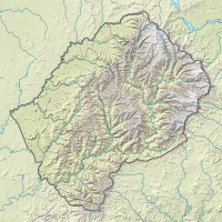
The national park is located in the Maloti Mountains in the extreme southeast of the country on the border with South Africa . It belongs to the district of Qacha's Nek , is 64.75 to 69.52 square kilometers and averages around 2,450 meters above sea level. Wide grasslands and sandstone formations predominate , which reach their greatest height here, while basalt occurs at this height in the rest of Lesotho . On the northern edge of the national park there are steep basalt mountains that are up to 2900 meters high. The area is criss-crossed by several year-round water-bearing rivers such as the Tsoelikane and has numerous wetlands . In the park is the Tsoelikane waterfall.
There is a small number of accommodations in the national park. It is part of the cross-border Maloti-Drakensberg Transfrontier Conservation Area (for example: Maloti-Drakensberg Transfrontier Conservation Area ). A twelve kilometer long border connects it with the uKhahlamba Drakensberg Park in South Africa . A footpath with the Ngoangoana Border Post or Bushman's Nek connects both areas.
history
The area was long inhabited by the San , who left rock paintings in at least 65 places . Sehlabathebe National Park was established on May 8, 1969, three years after Lesotho gained independence. It is named after a nearby settlement west of the area. Originally it was set up as Wild Life Sanctuary and National Park without a solid legal basis . It was only officially recognized as a national park with the National Park Act of 2001. In 2008 he was on the list of candidates for the UNESCO - World Heritage added. In 2013 it was included in the UNESCO World Heritage Site as part of the Maloti Drakensberg Transboundary World Heritage Site, the greater part of which is the uKhahlamba-Drakensberg Park.
Flora, fauna and climate
Due to the low population density of the area and the remote location, which makes it difficult for tourists to get there, numerous plant and animal species can develop there. They include endemic species such as the fish Pseudobarbus quathlambae and the Sehlabathebe water lily ( Aponogeton ranunculiflorus ), which are only protected in the national park. The plant species belong to the afro-alpine and sub-alpine species. Due to the proximity to the Indian Ocean, there are also frequent temperature drops and strong winds in summer.
See also
Web links
- Description of the Maloti-Drakensberg Park on UNESCO's website (English)
- Information about the park at sabonet.org.za ( Memento from December 26, 2007 in the Internet Archive ) (English; archive version)
Individual evidence
- ↑ Sehlabathebe in Lesotho. Protected Planet / IUCN. Retrieved June 5, 2019.
- ^ Extension of uKhahlamba / Drakensberg Park. UNESCO, April 2013. (PDF)
- ↑ 2017 Environment Report. Bureau of Statistics, 2017, p. 20.
- ↑ a b c Description of the national park on the UNESCO website (English), accessed on February 3, 2014
- ↑ UNESCO World Heritage , accessed on June 28, 2013


