Serga (Ufa)
|
Serga Серга́ |
||
|
|
||
| Data | ||
| Water code | RU : 10010201112111100020636 | |
| location | Sverdlovsk Oblast ( Russia ) | |
| River system | Volga | |
| Drain over | Ufa → Belaya → Kama → Volga → Caspian Sea | |
| source |
Central Urals 56 ° 29 ′ 28 ″ N , 59 ° 43 ′ 10 ″ E |
|
| muzzle | at Michailowsk in the Ufa coordinates: 56 ° 25 ′ 46 ″ N , 59 ° 4 ′ 29 ″ E 56 ° 25 ′ 46 ″ N , 59 ° 4 ′ 29 ″ E |
|
| Mouth height |
243 m
|
|
| length | 113 km | |
| Catchment area | 2170 km² | |
| Flowing lakes | Mikhailovsky Prud | |
| Small towns | Verkhniy Sergi , Nizhniy Sergi , Mikhailovsk | |
|
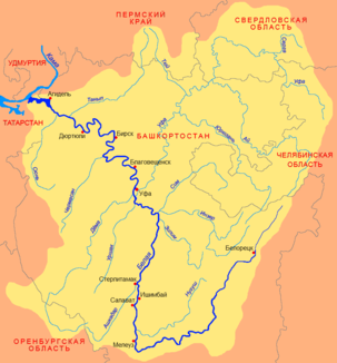
Location of the Serga (Серга́) in the catchment area of the Belaja |
||
The Serga ( Russian Серга́ ) is a right tributary of the Ufa in the Sverdlovsk Oblast in the European part of Russia .
It rises in the Middle Urals . It flows first in a northerly direction. At Verkhniy Sergi it turns west, passes Nizhniy Sergi , and then flows south in wide loops. It flows through Lake Michailowski Prud and finally flows into the Ufa at Michailowsk on the right. The Serga has a length of 113 km and drains an area of 2170 km². The Serga is used for rafting .
