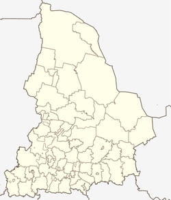
Verkhnie Sergi
| Urban-type settlement
Verkhnie Sergi
Верхние Серги
|
||||||||||||||||||||||||||||||||
|
||||||||||||||||||||||||||||||||
|
||||||||||||||||||||||||||||||||
Verkhniye Sergi ( Russian Ве́рхние Серги́ ) is an urban-type settlement in the Sverdlovsk Oblast in Russia with 6,105 inhabitants (as of October 14, 2010).
geography
The place is about 70 km as the crow flies west-southwest of the Yekaterinburg Oblast Administrative Center on the western, European side of the central Urals . It is located on the upper reaches of the right Ufa tributary Serga, which is dammed up there together with its right tributary Kosja to the Werchne-Serginski prud ( pond ) .
Verkhnye Sergi belongs to the Nizhneserginsky Raion and is located 16 km east of its administrative center Nizhnye Sergi . The settlement is the seat and only locality of the municipality of the same name (gorodskoje posselenije) Verkhnie Sergi.
history
The place was created in 1742 in connection with the establishment of the Verkhne-Serginsky zavod ironworks by Nikita Nikititsch Demidow, the younger son of the founder of the industrial dynasty Nikita Demidow . The designation ("Upper Serga-Werk"), to which today's place name goes back, refers to the location on the river in contrast to the Nizhne-Serginski sawod ("Lower Serga Works") in today's Nizhny Sergi.
The factory, which still exists today - in the 1930s, re-profiled to manufacture drilling equipment - determined the development of the place from then on. In 1938 it received urban-type settlement status.
Population development
| year | Residents |
|---|---|
| 1939 | 6287 |
| 1959 | 8808 |
| 1970 | 8774 |
| 1979 | 8356 |
| 1989 | 7515 |
| 2002 | 6629 |
| 2010 | 6105 |
Note: census data
traffic
The nearest train station is at the urban-type Atig settlement about seven kilometers to the northwest, at 270 kilometer of the line from Kalino (near Tschussowoi ) via Druzhinino to Berdjausch, which opened in 1916 as the West Ural Railway . A freight connection line led from Atig to Verkhniye Sergi, but it was closed and dismantled in 2012.
There is also a road connection via Atig to the regional road, which branches off the federal trunk road R242 Perm - Yekaterinburg at Druzhinino, which is just under 20 km to the north , initially following the railway line to Mikhailovsk south and then heading west via Arti to Krasnoufimsk .
Sons and daughters of the place
- Marina Korowina (* 1984), biathlete
Web links
Individual evidence
- ↑ a b Itogi Vserossijskoj perepisi naselenija 2010 goda. Tom 1. Čislennostʹ i razmeščenie naselenija (Results of the All-Russian Census 2010. Volume 1. Number and distribution of the population). Tables 5 , pp. 12-209; 11 , pp. 312–979 (download from the website of the Federal Service for State Statistics of the Russian Federation)


