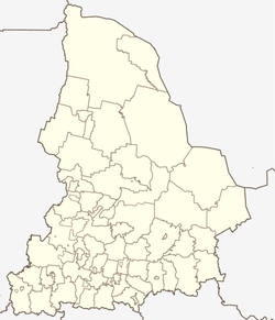
Gari (Sverdlovsk)
| Urban-type settlement
Gari
Гари
|
||||||||||||||||||||||||||||||||||
|
||||||||||||||||||||||||||||||||||
|
||||||||||||||||||||||||||||||||||
Gari ( Russian Га́ри ) is an urban-type settlement in the Sverdlovsk Oblast in Russia with 2,472 inhabitants (as of October 14, 2010).
geography
The place is a good 300 km as the crow flies north-northeast of the Yekaterinburg Oblast Administrative Center in the western part of the West Siberian lowlands . It is located on the right bank of the Soswa , about 12 km above its confluence with the Loswa to the Tawda .
Gari is the administrative center of the urban district of Gari , which includes a total of 41 villages and rural settlements. The settlement is free of parishes, as there is no corresponding administrative level (here city parish / gorodskoje posselenije ), as is common in urban districts in Russia.
history
The place was in 1623 on the orders of the provincial governors of Pelym as Garinskaja Sloboda founded. The more intensive settlement of the area began after the suppression of the Pugachev uprising in 1775 by exiles . As a village, the place was first called Garinskoye , later shortened to the current form.
On February 27, 1924, Gari became the administrative seat of one of the Rajons named after him, which was spun off from the former Ujesd Verkhoturje . Since 1968 Gari has had the status of an urban-type settlement. The Rajon was converted into an urban district on January 1, 2006.
Population development
| year | Residents |
|---|---|
| 1939 | 1599 |
| 1959 | 4038 |
| 1970 | 4455 |
| 1979 | 5085 |
| 1989 | 5220 |
| 2002 | 4673 |
| 2010 | 2472 |
Note: census data
traffic
Gari is the end point of the 160 km long regional road 65K-2304 from Serow via Soswa , where the nearest railway station on the Serow - Alapayevsk line is about 40 km southwest . The 200 km long 65K-1003 leads in a south-easterly direction to the neighboring administrative center of Tabory .
The last sections of an extensive, narrow-gauge forest railway network with its starting point at Soswa, which originated in the middle of the 20th century and also touched Gari, were shut down in the 2000s. There is a small regional airport on the eastern edge of the town.
Web links
Individual evidence
- ↑ a b Itogi Vserossijskoj perepisi naselenija 2010 goda. Tom 1. Čislennostʹ i razmeščenie naselenija (Results of the All-Russian Census 2010. Volume 1. Number and distribution of the population). Tables 5 , pp. 12-209; 11 , pp. 312–979 (download from the website of the Federal Service for State Statistics of the Russian Federation)


