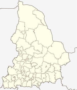
Sosva (Sverdlovsk)
| Urban-type settlement
Sosva
Сосьва
|
||||||||||||||||||||||||||||||||||||
|
||||||||||||||||||||||||||||||||||||
|
||||||||||||||||||||||||||||||||||||
Soswa ( Russian Сосьва ) is an urban-type settlement in Sverdlovsk Oblast ( Russia ) with 9,634 inhabitants (as of October 14, 2010).
geography
The settlement is located in the west of the West Siberian lowlands , a good 260 km as the crow flies northeast of the Oblast capital Yekaterinburg on the left bank of the Soswa .
Sosva part of the namesake city district Sosva (previously Rajon Serov), situated some 85 kilometers southeast of the administrative center Serov .
history
As the first Russian settlement in the area around today's Soswa, which was previously inhabited exclusively by Mansen , the village of Koschai, a few kilometers upstream on the other side of the river, was built around the year 1600. A large number of places were founded by - partly exiled - Strelizi and other resettlers from the Verkhoturye area after 1680. In the 18th and 19th centuries, these villages formed the Wolost (village community) Soswa des Ujesds Verkhoturje.
In 1880 the construction of the Soswinski Sawod ironworks ("Soswa-Werk") began on the lands of the village of Koschai , from whose factory settlement today's Soswa developed. The plant was closed again in 1927, but a “wood processing combine” was built in its place.
On November 16, 1938, the place received its current name of the status of an urban-type settlement.
From 1941 to at least 1960 the administration of the Northern Ural Penal Camp (SewUralLag) in the Gulag system was in Soswa, with at times more than 33,000 prisoners. A larger prison camp still exists in Soswa today.
Since 1923 the settlement has belonged to Nadeschdinski Raion, which was renamed Serow Raion together with the city in 1940 and was transformed into the Soswa District as part of the administrative reform in Russia in 2005.
Population development
| year | Residents |
|---|---|
| 1939 | 5,337 |
| 1959 | 14,283 |
| 1970 | 11,295 |
| 1979 | 10,463 |
| 1989 | 10,412 |
| 2002 | 10,341 |
| 2010 | 9,634 |
Note: census data
Economy and Infrastructure
In Soswa as a forestry center there are companies in the wood processing industry.
Eight kilometers southwest of the town center is the station Soswa Nowaja ("New Soswa") of the Serow - Alapajewsk - Bogdanowitsch railway line, which opened on this section in 1947 (route km 91). A 16 km long freight connecting line branches off from the Novaya Sarja station further north on the line (km 81), which leads to the center of the village ( Soswa station ). This had been part of a narrow-gauge line from Serow (then Nadeschdinski Sawod, with the ironworks of the same name) since the beginning of the 20th century , which was converted to broad-gauge in 1935 .
Starting in 1948, starting from Soswa in the area to the right of the Soswa, a narrow-gauge network with a gauge of 750 mm was set up for forestry and passenger transport. It was named after the village Solovyovka, which was first reached, the Solovyovsk Narrow Gauge Railway and in its heyday had a maximum length of about 350 km. After the wooden bridge along the route, which in Sosva river Sosva crossed, had been destroyed by a flood in 1998, the business was about 2007, almost all set. Only a short section in the area of the Soswa settlement on the left bank of the river is still used for the purposes of the prison camp located here.
Road connection from Soswa also exists in the direction of Serow. Other roads lead in a southerly direction to the settlement of Vostochny an der Tura and on to Verkhoturye and the Sosva down to the administrative center of the neighboring district of Gari . A road bridge over the Soswa has existed a few kilometers above the settlement along the road towards Vostotschny since around 2009.
Sons and daughters of the place
- Eugen Ruge (* 1954), German writer and director
Individual evidence
- ↑ a b Itogi Vserossijskoj perepisi naselenija 2010 goda. Tom 1. Čislennostʹ i razmeščenie naselenija (Results of the All-Russian Census 2010. Volume 1. Number and distribution of the population). Tables 5 , pp. 12-209; 11 , pp. 312–979 (download from the website of the Federal Service for State Statistics of the Russian Federation)
- ↑ History of the Soswa District ( Memento from December 29, 2018 in the Internet Archive ) on the Heraldry of Sverdlovsk Oblast website (Russian)
- ↑ SewUralLag on the GULAG website of Memorial Deutschland e. V.
- ^ Branch line Novaya Zarya - Soswa on the website of Sergei Bolashenko (Russian, photos)
- ↑ Solovyovsk Narrow- Gauge Railway on the website of Sergei Bolashenko (Russian, photos)


