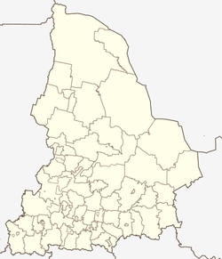
Uralsky (Sverdlovsk)
| Urban-type settlement
Uralski
Уральский
|
||||||||||||||||||||||||||||||||||||||||||||
|
||||||||||||||||||||||||||||||||||||||||||||
|
||||||||||||||||||||||||||||||||||||||||||||
Uralsky ( Russian Ура́льский ) is a "closed" urban-type settlement in the Sverdlovsk Oblast in Russia with 2,444 inhabitants (as of October 14, 2010).
geography
The place is east of the Urals about 35 km as the crow flies south-east of the Yekaterinburg Oblast Administrative Center , a good 5 km from the left bank of the Isset .
Uralsky is the only town that forms an urban district of the same name on the border between the urban districts of Syssert (west) and Belojarski (east).
history
The place was established in 1960 as a military settlement at a location of the Strategic Missile Forces of the Soviet Union and was given the cover name Kossulino-1, with reference to the Kossulino train station 8 km north of the Verkhneje Dubrovo settlement; It was also shown on maps as Chrisolitowy , after a train station 2 km to the west. By resolution of January 4, 1994, the settlement was declared a closed administrative-territorial entity (SATO) under its current name. Since June 13, 1995 it has had its own independent administration, since January 1, 2006 with the status of a city district.
Population development
| year | Residents |
|---|---|
| 2002 | 2311 |
| 2010 | 2444 |
Note: census data
traffic
The federal trunk road R354 to Kurgan passes just under 3 km north of Uralsky and branches off from the R351 (part of European route 22 ) from Yekaterinburg to Tyumen 7 km north-west near Verkhneye Dubrovo .
To the west of the settlement is the closest train station, Chrisolitowy, at kilometer 34 of the Yekaterinburg - Kurgan line, which opened in 1933 and has been electrified since 1972 .
Web links
Individual evidence
- ↑ a b Itogi Vserossijskoj perepisi naselenija 2010 goda. Tom 1. Čislennostʹ i razmeščenie naselenija (Results of the All-Russian Census 2010. Volume 1. Number and distribution of the population). Tables 5 , pp. 12-209; 11 , pp. 312–979 (download from the website of the Federal Service for State Statistics of the Russian Federation)
- ↑ Soviet General Staff Map 1: 100: 000. Sheet O-41-111. Edition 1986


