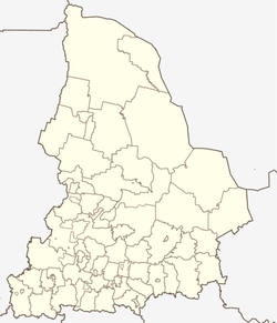
Atig
| Urban-type settlement
Atig
Atig
|
||||||||||||||||||||||||||||||||||||||
|
||||||||||||||||||||||||||||||||||||||
|
||||||||||||||||||||||||||||||||||||||
Atig ( Russian А́тиг ) is an urban-type settlement in the Sverdlovsk Oblast in Russia with 3405 inhabitants (as of October 14, 2010).
geography
The place is located about 75 km as the crow flies west-southwest of the Yekaterinburg Oblast Administrative Center on the western, European side of the central Urals . It is located on the river Bolshoi Atig (Great Atig), which is dammed up to the Atigski prud ( pond ), which flows a little south into the right-hand Ufa tributary Serga .
Atig belongs to Rajon Nischneserginski and is located less than 10 km east-northeast of the administrative center of Nizhniye Sergi . The settlement is the seat and only locality of the municipality of the same name (gorodskoje posselenije) Rabotschi possjolok Atig ("Atig workers' settlement").
history
The place probably goes back to an older Bashkir settlement, not far from which Russians also settled in the 1740s after ironworks had been built in Nizhniy Sergi and Verkhniy Sergi . Atig is about halfway between these locations. The actual year of foundation, however, is 1790, when an ironworks also started operations in Atig. After the temporary closure of the plant in 1891, metal products were manufactured there from 1897 . In 1929 Atig received urban-type settlement status.
Population development
| year | Residents |
|---|---|
| 1939 | 3634 |
| 1959 | 4220 |
| 1970 | 4239 |
| 1979 | 4462 |
| 1989 | 4499 |
| 2002 | 3906 |
| 2010 | 3405 |
Note: census data
traffic
In Atig there is a train station at kilometer 270 on the line from Kalino (near Tschussowoi ) via Druzhinino to Berdjausch, which opened in 1916 as the West Ural Railway . A freight connection line led from Atig to Verkhniye Sergi, but it was closed and dismantled in 2012.
To the northwest, Atig and the neighboring Nizhnye Sergi are bypassed by a regional road, which branches off the federal highway R242 Perm - Yekaterinburg at Druzhinino, which is just under 20 km to the north , initially following the railway line to Mikhailovsk to the south and then heading west via Arti to Krasnoufimsk . The original road leads through the localities of Atig, where a side road to Verkhniye Sergi begins, and Nizhnye Sergi.
Web links
Individual evidence
- ↑ a b Itogi Vserossijskoj perepisi naselenija 2010 goda. Tom 1. Čislennostʹ i razmeščenie naselenija (Results of the All-Russian Census 2010. Volume 1. Number and distribution of the population). Tables 5 , pp. 12-209; 11 , pp. 312–979 (download from the website of the Federal Service for State Statistics of the Russian Federation)


