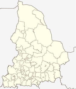
Kamyshlov
| city
Kamyshlov
Kamyslov
|
||||||||||||||||||||||||||||||||||||||||||
|
||||||||||||||||||||||||||||||||||||||||||
|
||||||||||||||||||||||||||||||||||||||||||
| List of cities in Russia | ||||||||||||||||||||||||||||||||||||||||||
Kamyshlov ( Russian Камышлов ) is a city in Sverdlovsk Oblast in Russia with 26,870 inhabitants (as of October 14, 2010).
geography
The city is located in the west of the West Siberian lowlands , about 140 km east of the oblast capital Yekaterinburg on the left bank of the Pyschma , a right tributary of the Tura in the Ob river system .
Kamyshlov is the center of an urban district of the same name .
The city lies on the Sverdlovsk - Tyumen railway line, which was opened in 1885 (which became part of the northern route of the Trans-Siberian Railway in 1913 with the continuation of Tyumen to Omsk ).
history
The place was founded in 1668 as Ostrog Kamyshevsky , named after the river Kamyschlowka or Kamyschenka (from the Tatar and Russian word for ledge ) which flows into the Pyschma . From 1687 the place was called Kamyshlovskaya Sloboda . From the 18th century the western section of the Siberian tract ran through the place, which developed into an important trading center, especially for grain, and which remained so until the beginning of the 20th century (see city arms). In 1781 the place received city rights.
When the Kyshtym accident occurred in the Mayak nuclear facility in the fall of 1957 , extensions of the radioactive cloud reached the city.
Population development
| year | Residents |
|---|---|
| 1897 | 8,210 |
| 1926 | 9,900 |
| 1939 | 17,516 |
| 1959 | 30,137 |
| 1970 | 30,770 |
| 1979 | 31,939 |
| 1989 | 33,462 |
| 2002 | 28,914 |
| 2010 | 26,870 |
Note: census data (1926 rounded)
Culture and sights
Various buildings from the 19th century and the beginning of the 20th century have been preserved in Kamyshlov, such as the Cathedral of the Protection and Intercession of the Virgin Mary ( Покровский собор / Pokrowski sobor), the buildings of the printing works and the former grammar school, Art Nouveau - The station building and merchants' houses along Karl-Marx-Strasse (uliza Karla Marksa).
The city has a history and local museum.
The balneological- climatic health resort Obuchowo, opened in 1871, is located seven kilometers west of the city .
economy
The main branches of industry in Kamyshlov are light and food industries as well as construction.
Individual evidence
- ↑ a b Itogi Vserossijskoj perepisi naselenija 2010 goda. Tom 1. Čislennostʹ i razmeščenie naselenija (Results of the All-Russian Census 2010. Volume 1. Number and distribution of the population). Tables 5 , pp. 12-209; 11 , pp. 312–979 (download from the website of the Federal Service for State Statistics of the Russian Federation)
- ↑ Henning Sietz: The Menetekel from Mayak. Die Zeit , August 27, 2008, accessed on December 17, 2010 .
Web links
- City administration website (Russian)
- Kamyshlov on mojgorod.ru (Russian)


