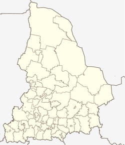
Bissert (Russia)
| Urban-type settlement
Bissert
Бисерть
|
||||||||||||||||||||||||||||||||||
|
||||||||||||||||||||||||||||||||||
|
||||||||||||||||||||||||||||||||||
| List of large settlements in Russia | ||||||||||||||||||||||||||||||||||
Bissert ( Russian Бисерть ) is an urban-type settlement in Sverdlovsk Oblast ( Russia ) with 10,233 inhabitants (as of October 14, 2010).
geography
The settlement is located on the western flank of the Middle Urals , almost 100 kilometers (as the crow flies) west of the Oblast capital Yekaterinburg on the Bissert of the same name , a right tributary of the Ufa . The Bissert is dammed into a small dam (Bissertski prud) .
Bissert belongs to Rajon Nizhniye Sergi ; the administrative center of Nizhny Sergi is 25 kilometers to the southeast.
history
The history of the place begins between 1735 and 1736, when a "fortress" ( Ostrog ) was built on behalf of the administrator of the Ural mines Vasily Tatishchev to defend the area against Bashkir incursions .
In 1761 the entrepreneur Grigori Demidow had an iron works built and for this purpose dammed the river into a "pond". The plant and location was named Bissertski sawod after the name of the river . The origin of the name is unclear. After Grigori Demidow's death in the same year, the work went to his son Pawel Demidow and remained in the possession of the Demidow family until 1873 .
During the Pugachev uprising , the plant was temporarily in the hands of the rebels in 1774.
Previously belonging to the Ujesd Krasnoufimsk of the Perm Governorate , Bissert was the first administrative center of a raion of the same name in 1923 ; In 1932, however, this was attached to the Nizhniy Sergi Rajon.
Until 1925, iron was smelted based on local ore deposits in the plant. During the Second World War , the plant produced artillery shells . In 1942 the place received the status of an urban-type settlement under its current name. In 1944 a Bissert Rajon was again expelled, but in 1959 it was again part of the Nizhniy Sergi Rajon.
After the war, the factory was converted to the production of agricultural equipment as well as armaments and everyday goods.
Population development
| year | Residents |
|---|---|
| 1878 | 1,152 |
| 1939 | 7.141 |
| 1959 | 11,573 |
| 1970 | 13,181 |
| 1979 | 11,671 |
| 1989 | 12,646 |
| 2002 | 11,262 |
| 2010 | 10,233 |
Note : from 1939 census data
Economy and Infrastructure
The largest company is what is now called the Uralselmasch ("Ural Agricultural Machinery Plant ") . Forestry also plays an important role.
Bissert is on the railway line Moscow - Kazan - Ekaterinburg (station name Bissertski Sawod ; route kilometers 1535). The R242 trunk road - part of the European route 22 - Perm - Ekaterinburg passes immediately to the south of the village .
Individual evidence
- ↑ a b Itogi Vserossijskoj perepisi naselenija 2010 goda. Tom 1. Čislennostʹ i razmeščenie naselenija (Results of the All-Russian Census 2010. Volume 1. Number and distribution of the population). Tables 5 , pp. 12-209; 11 , pp. 312–979 (download from the website of the Federal Service for State Statistics of the Russian Federation)
- ↑ a b History of the work and the location on the Heraldik der Sverdlovsk Oblast website (Russian).


