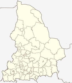
Baikalovo (Sverdlovsk)
| Village
Baikalowo
Байкалово
|
||||||||||||||||||||||||||||||||||||
|
||||||||||||||||||||||||||||||||||||
|
||||||||||||||||||||||||||||||||||||
Baikalowo ( Russian Байка́лово ) is a village (selo) in Sverdlovsk Oblast in Russia with 5789 inhabitants (as of October 14, 2010).
geography
The place is located about 200 km as the crow flies east-northeast of the Yekaterinburg Oblast Administrative Center in the West Siberian lowlands . It is located at the confluence of the Lipowka and the Sarabaika in the Jelinka, which flows 10 km north of the right Niza tributary Ilenka. At Baikalowo the Jelinka is dammed to the small reservoir Baikalowski prud .
Baikalowo is the administrative center of the Rajons Baikalowski and seat of the rural community Baikalowskoje selskoje posselenije, to the 25 other, within up to 30 km by villages belong (only seven of them with more than 100 inhabitants, the largest is Ljapunowo 17 km west of nearly 1,000 inhabitants, Status 2010).
history
The village was founded around 1630 during the Russian advance into Siberia as Baikalovskaya Sloboda . The etymology of the name is unclear, possibly derived from the name of a Tatar local ruler ( Bai or Baikal ) who lived in the area .
Since November 12, 1923, Baikalowo has been the administrative seat of a Rajon named after him. From August 10, 1972 to 1997, the place had the status of an urban-type settlement .
Population development
| year | Residents |
|---|---|
| 1939 | 3159 |
| 1959 | 4423 |
| 1970 | 5266 |
| 1979 | 5500 |
| 1989 | 6758 |
| 2002 | 6144 |
| 2010 | 5789 |
Note: census data
traffic
To the west of Baikalowo runs the regional road 65K-282, which begins near Gorbunowskoje not far from Talitsa on the federal trunk road R351 Ekaterinburg - Tyumen (also European route 22 ) and continues in a north-westerly direction to Irbit . In an initially easterly direction, the 65K-0506 branches off to the neighboring district center of Turinskaja Sloboda and further up the right bank of the Tura to Turinsk .
The nearest train stations are around 40 km away on the Trans-Siberian Railway ( Talitsa near Troitski ) and in Irbit, around 50 km away, on the Yekaterinburg - Ustye Acha line ( Mezhduretschenski ).
A few kilometers south of the village was a small airfield ( ICAO code USTB ) that has been out of service since the early 1990s.
Web links
Individual evidence
- ↑ a b Itogi Vserossijskoj perepisi naselenija 2010 goda. Tom 1. Čislennostʹ i razmeščenie naselenija (Results of the All-Russian Census 2010. Volume 1. Number and distribution of the population). Tables 5 , pp. 12-209; 11 , pp. 312–979 (download from the website of the Federal Service for State Statistics of the Russian Federation)

