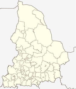
Troitsky (Sverdlovsk)
| settlement
Troitsky
Trotsky
|
||||||||||||||||||||||||||||||
|
||||||||||||||||||||||||||||||
|
||||||||||||||||||||||||||||||
| List of large settlements in Russia | ||||||||||||||||||||||||||||||
Troitski ( Russian Тро́ицкий ) is a rural settlement in the Sverdlovsk Oblast ( Russia ) with 10,467 inhabitants (as of October 14, 2010).
geography
The settlement is located in the west of the West Siberian lowlands , about 200 km as the crow flies east of the oblast capital Yekaterinburg and a good 100 km west of Tyumen on the Sugatka, a small left tributary of the Pyschma , a few kilometers above the mouth.
Troitski belongs to the urban district of Talitsa and is located about 5 km north of the center of the city of Talitsa .
history
The settlement was created in connection with the construction of the Yekaterinburg - Tyumen railway line , which opened in 1885 and has been part of the Trans-Siberian Railway since 1913 , around the Poklevskaya station that was created there. The station name referred to the family name of the most influential entrepreneur in the area, Alfons Poklewski-Kosell, who came from the Polish-Lithuanian noble family Koziełł-Poklewski (Koziela-Poklevskis) and operated factories in nearby Taliza. The place itself was initially called like the train station, from around the turn of the century after the Swjato-Troitsky church (Russian for Holy Trinity ) built there, and from the 1920s onwards only Troitski. From 1928 to 2004 Troitsky had urban-type settlement status .
Population development
| year | Residents |
|---|---|
| 1939 | 5,252 |
| 1959 | 9,955 |
| 1970 | 9,436 |
| 1979 | 10.135 |
| 1989 | 12,486 |
| 2002 | 11,266 |
| 2010 | 10,467 |
Note: census data
traffic
The settlement is on the Trans-Siberian Railway (station name since 1963 Taliza, after the nearby small town; distance kilometers 2028 from Moscow ). From there a freight connection line leads to Taliza. The federal trunk road R351 , which connects Ekaterinburg with Tyumen and is part of European route 22 , runs a few kilometers north of Troitsky .
Individual evidence
- ↑ a b Itogi Vserossijskoj perepisi naselenija 2010 goda. Tom 1. Čislennostʹ i razmeščenie naselenija (Results of the All-Russian Census 2010. Volume 1. Number and distribution of the population). Tables 5 , pp. 12-209; 11 , pp. 312–979 (download from the website of the Federal Service for State Statistics of the Russian Federation)

